Karhunkierros trail, from Hautajärvi to Taivalköngäs, day 1
I planned to hike the Karhunkierros trail for four days, Monday through Thursday, averaging about 20km per day, for the 82km length. I aimed to arrive at the Ruka resort on Thursday at the end of the day. Estimating around 3-4 hours of hiking + stops for eating and rest. If the terrain is rugged, I would need to add 1-2 hours to the travel time, so 4-6 hours per day.
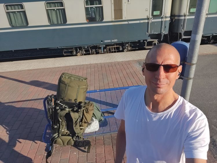
I chatted with the bus driver during the drive to Hautajärvi on Sunday, 14.8. and indeed, four days was the most common objective schedule for hiking parties set on the trail. Some groups took up to 7 days and explored a number of the nature trails branching from the Karhunkierros trail.
In fact, as a firm believer in preparation and planning, I had rehearsed and planned for the trip in advance as a first-timer to multiday hiking. But as always, when reality collides with a plan, reality wins. I was wrong on many accounts, some of which I will explore the lessons learned in this article.
The more popular modern version of Moltke the Elder's insight states,” No plan survives contact with the enemy.” – Strategic Plans Are Less Important than Strategic Planning, by Graham Kenny, in a 2016 HBR article.
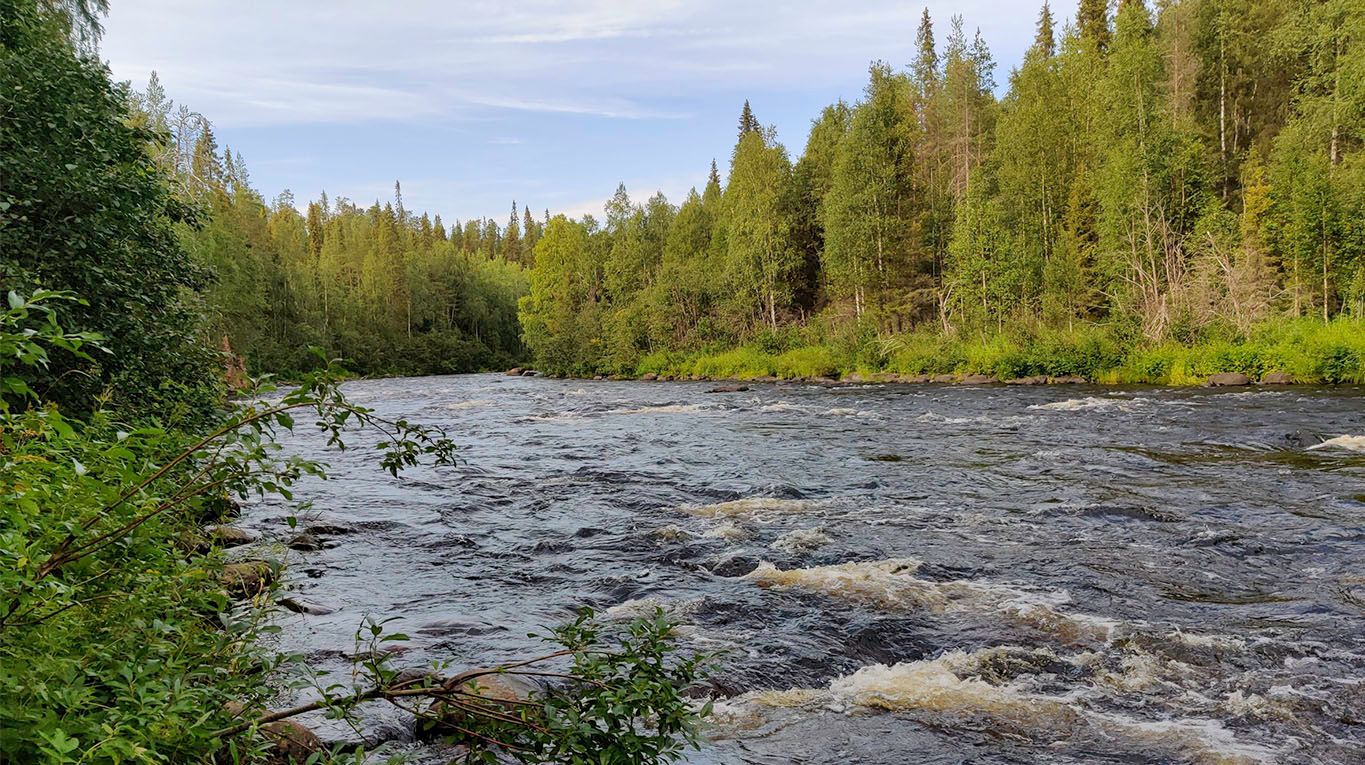
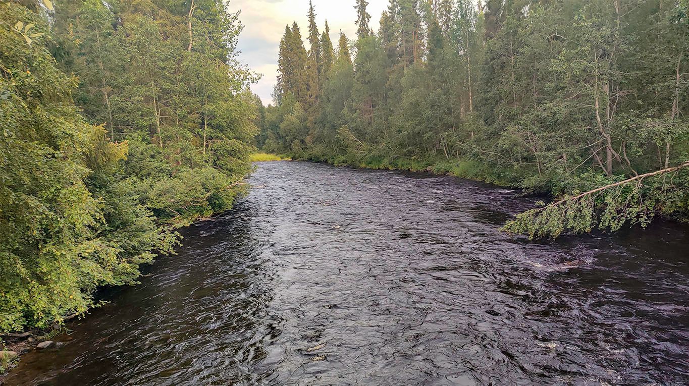
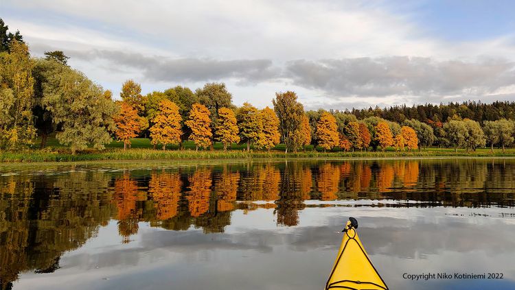
A new day dawns at Rytiniva campsite.
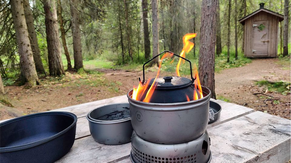
Waking up to a bright morning, with fresh air and the river streaming loudly, it was time for breakfast, coffee, and a look around. Where had I arrived in the dark of night? Moreover, it was my birthday today—what a great way to celebrate - a solid meal and start on the backpacking adventure ahead.
Lesson learned: The Rytiniva campsite is excellent, but there is room for only a few tents. Those arriving after the first handful of people will need to hike 6km to the next campsite. That will be at least a long hour of walking if it's nearing midnight.
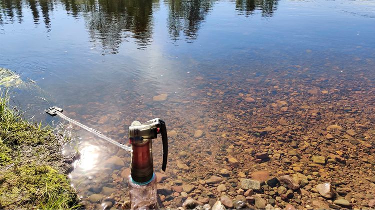
Priority was to get water resupplied. After the previous evening's travel and night, I had only a cup of water left. From the map and arriving at the site the last night, I knew the river was flowing right next to the campsite.
The video below is from the bridge in the picture above. No wonder the sound of the flow felt quite loud to a tent less than 10 meters away during the night.
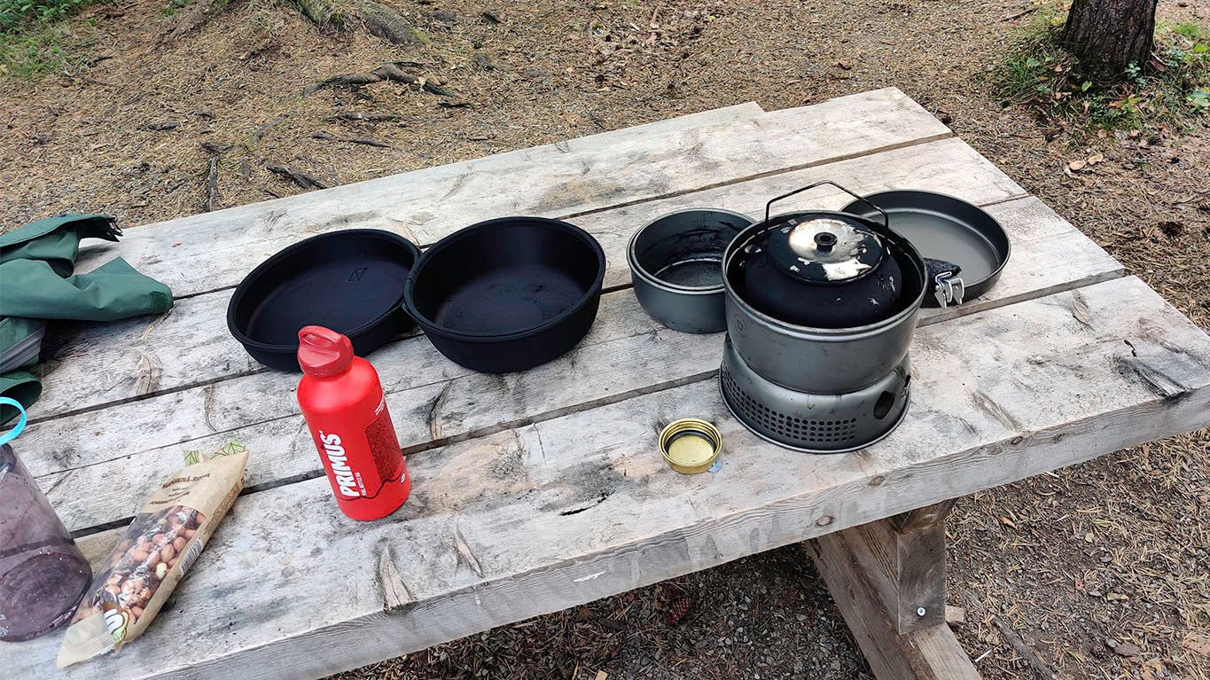
In planning for the backpacking, I opted for a good heavy-duty water filter purifier as the preferred method for getting drinking and cooking water for hydrating dehydrated meals.
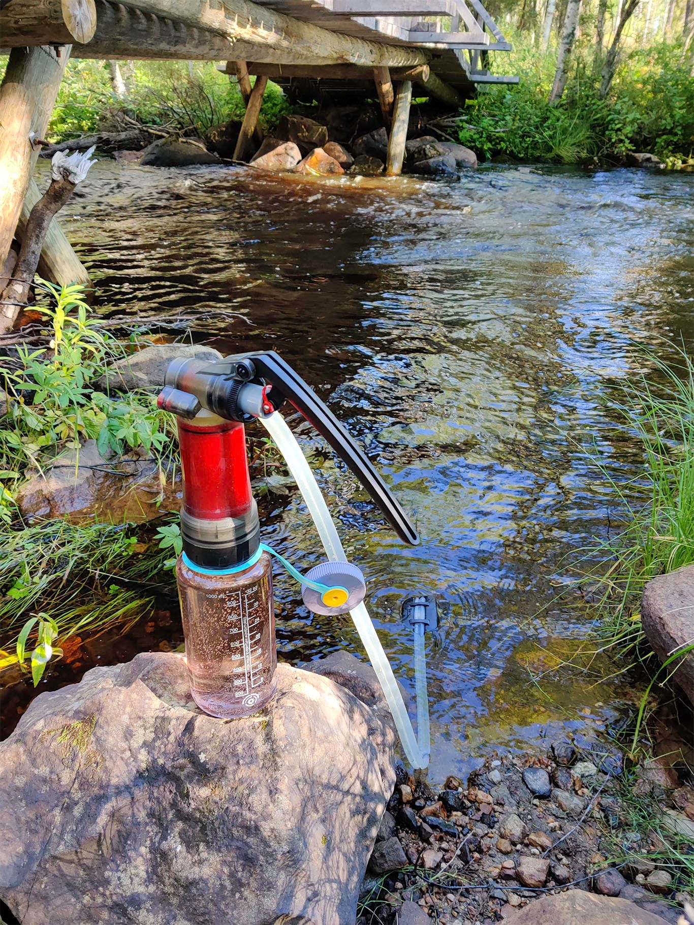
I can say that, personally, the water filter-purifier that allowed safe drinkable water re-supplied from streams at a fast rate (2l per minute) was absolutely essential for the success of my backpacking trip.
After water, next up was making breakfast before re-packing the tent and camp gear and setting off again. There will be a whole post about the gear used, so I won't go into those details yet.
In retrospect, I'll point out the vitamins at the bottom left of the photo. While planning, I thought that they would be a helpful complement to daily consumption. There would be no fresh vegetables or fruit for nearly a week, and the dehydrated rations can't compete with the richness of food we consume in the meals during the day.
Later I was advised by more experienced backpackers on the trail that these kinds of small extras add unnecessary weight. It's an excellent food for thought, how strictly necessary should we be while packing for the trip?
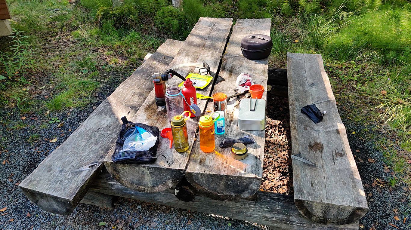
After packing the camp, I had to stop, unpack and repack the backpack's contents for a better balance, but that's a topic for another time. Finally, I was ready to set on the trail.
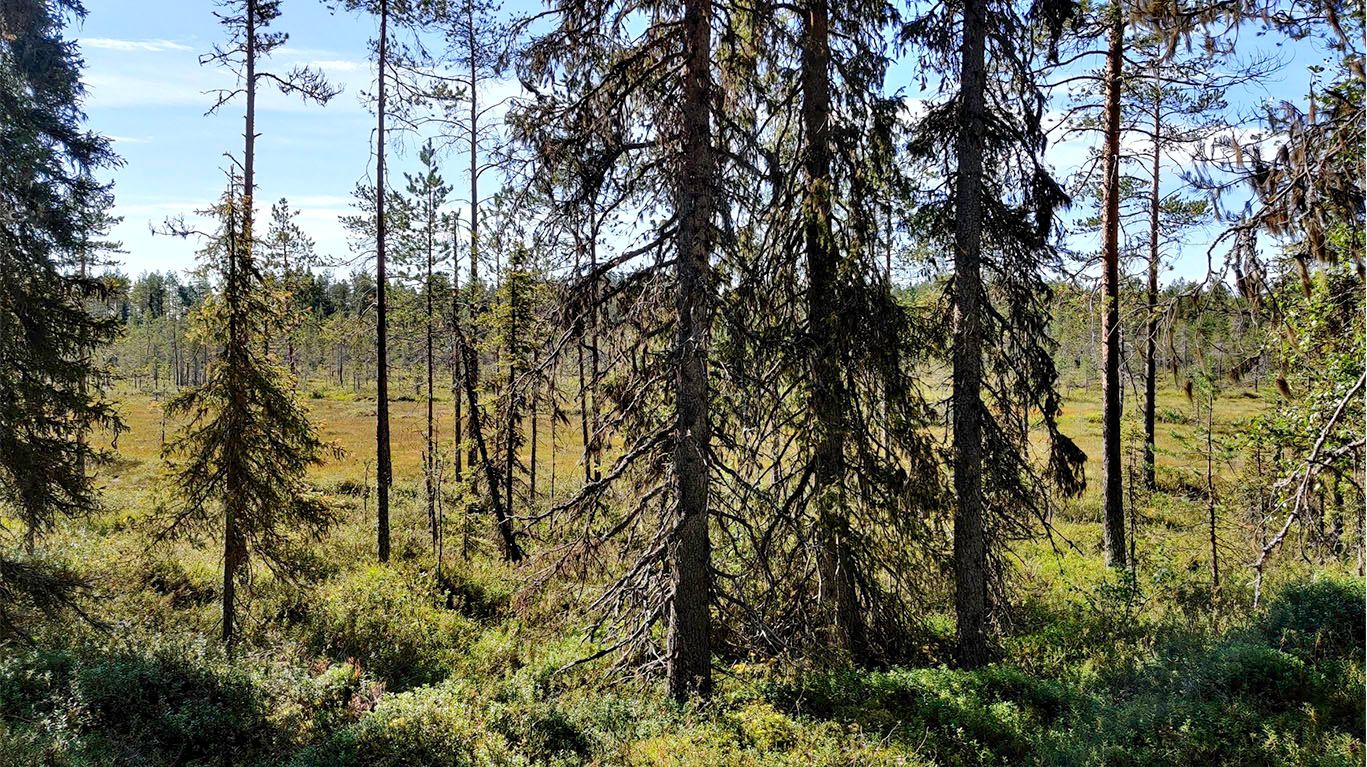
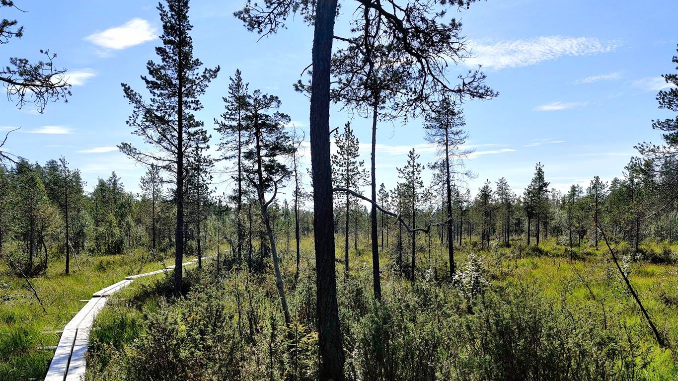
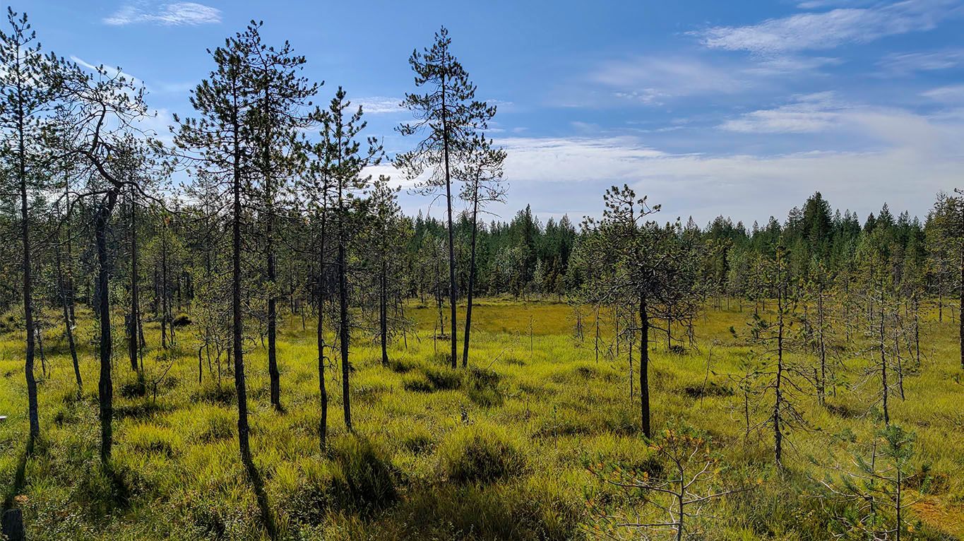
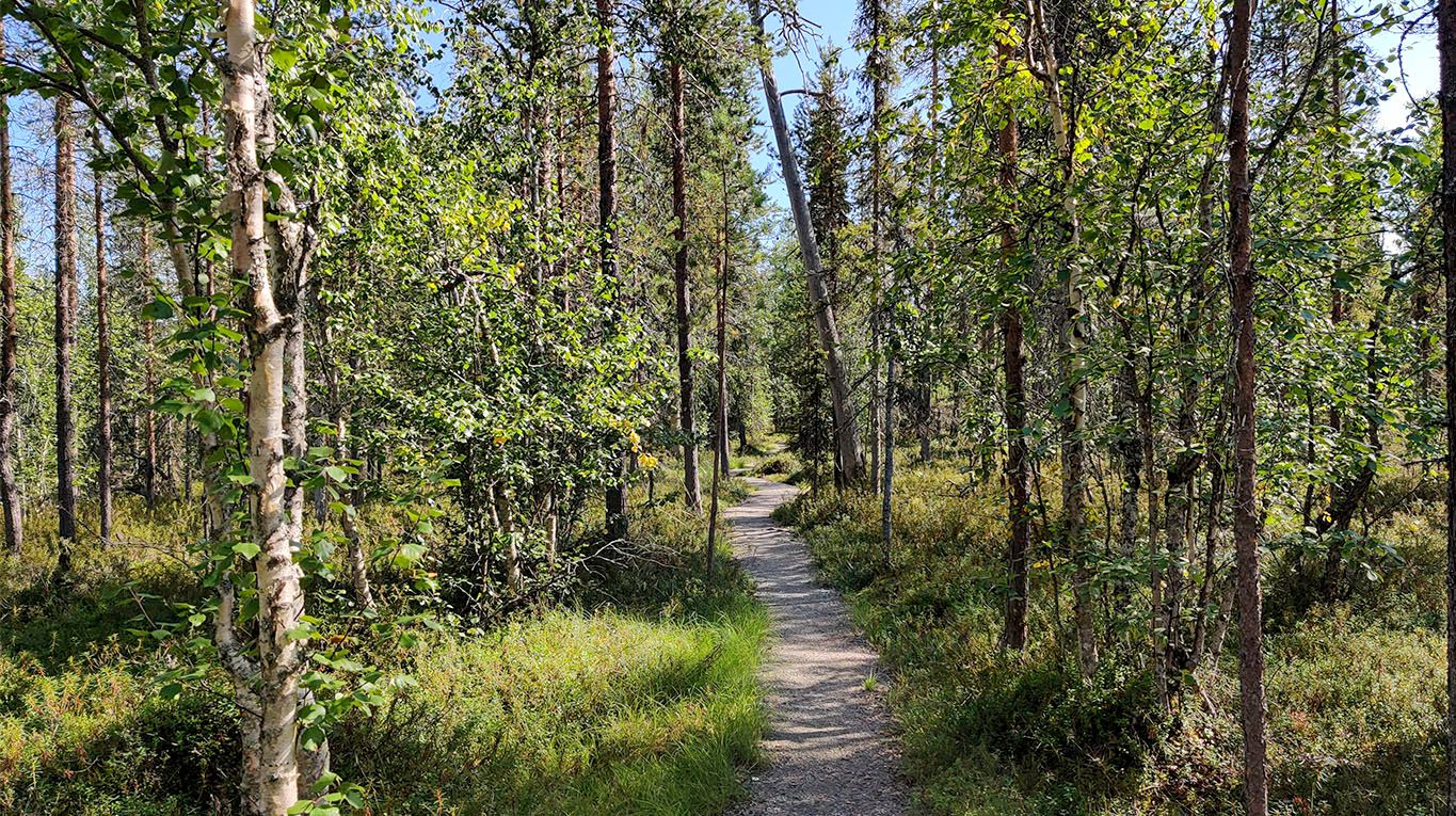
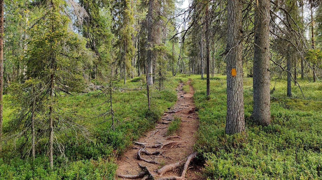
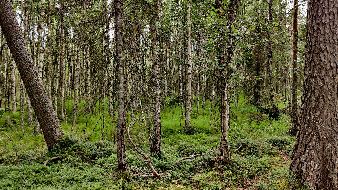
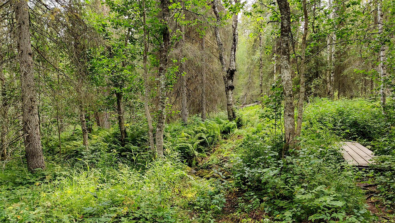
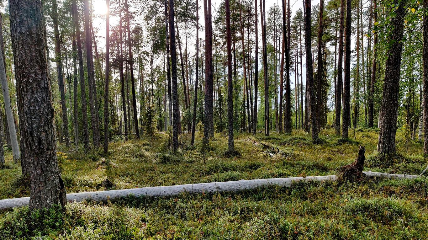
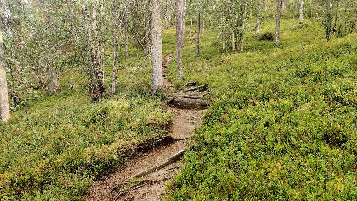
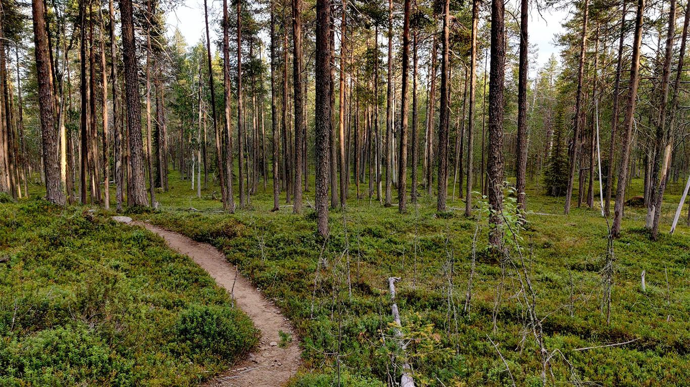
After leaving the Rytiniva campsite, the path dives into a dry heath forest, uncrowded with tall pines and spruces that reach upwards from the forest floor.
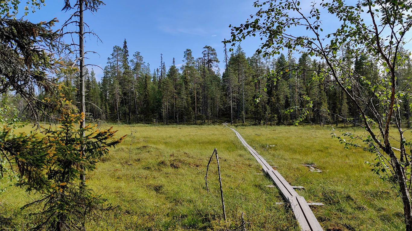
Intermittently marsh areas open on the sides of the path, with smaller trees and undergrowth in shades of darker green, orange, and brown.
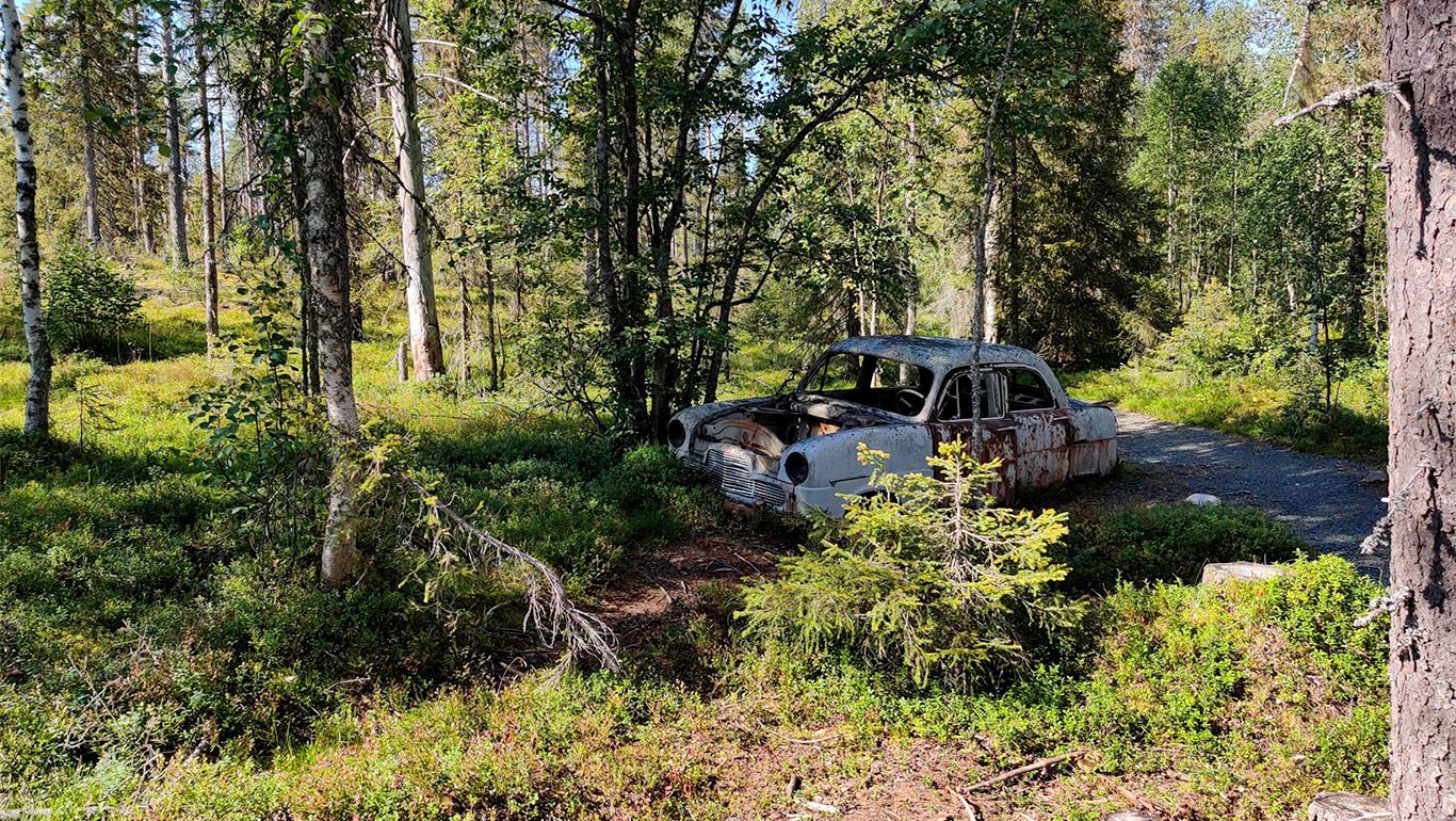
A car wreck is pictured above on the side of the trail. In the middle of the delightful beautiful nature, not too far from a few houses. Seeing something like this felt both very disappointing (in humanity) and eerily post-apocalyptic, where nature would have taken over the space occupied by humans. I've never seen a car wreck picked so clean, but why have they left the steering wheel in place?
Fortunately, this wreck also marks the beginning of the more scenic trail, it only gets better from here onwards.
Before the Koutajoki -river, an area of tall, bright green undergrowth between the trees of the mixed forest.
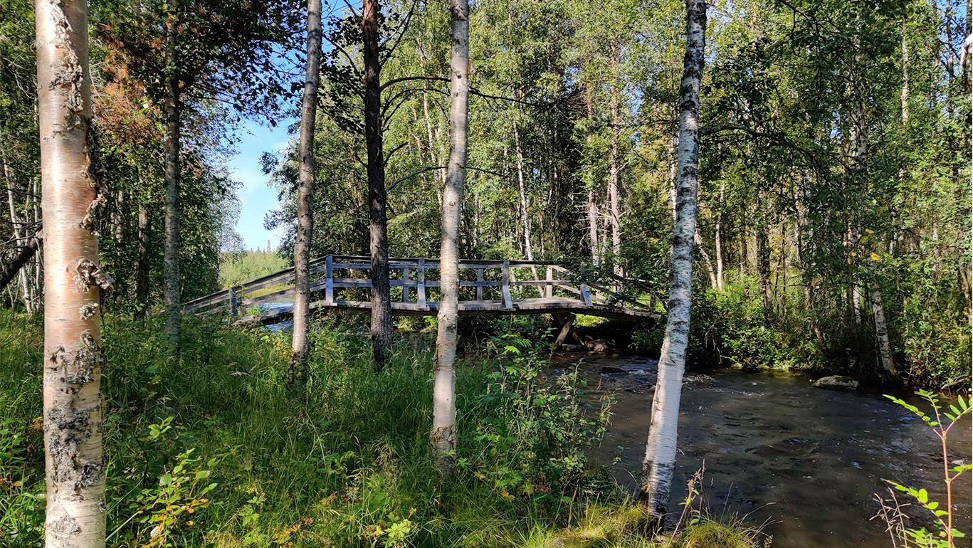
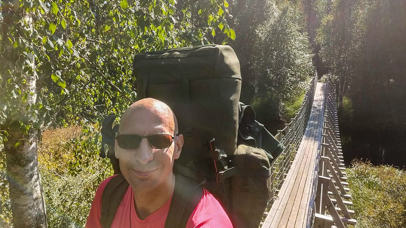
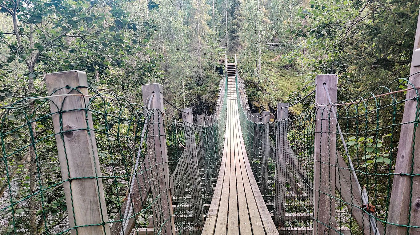
A rope bridge crossing the Koutajoki-river, one of many to come. Built very sturdy and balanced manner, it did not so much as tilt, let alone swing, when walking over it.
During midday, in a nearly cloudless sky, it was so bright that I used the shadow of the tree to get a shot of the marsh.
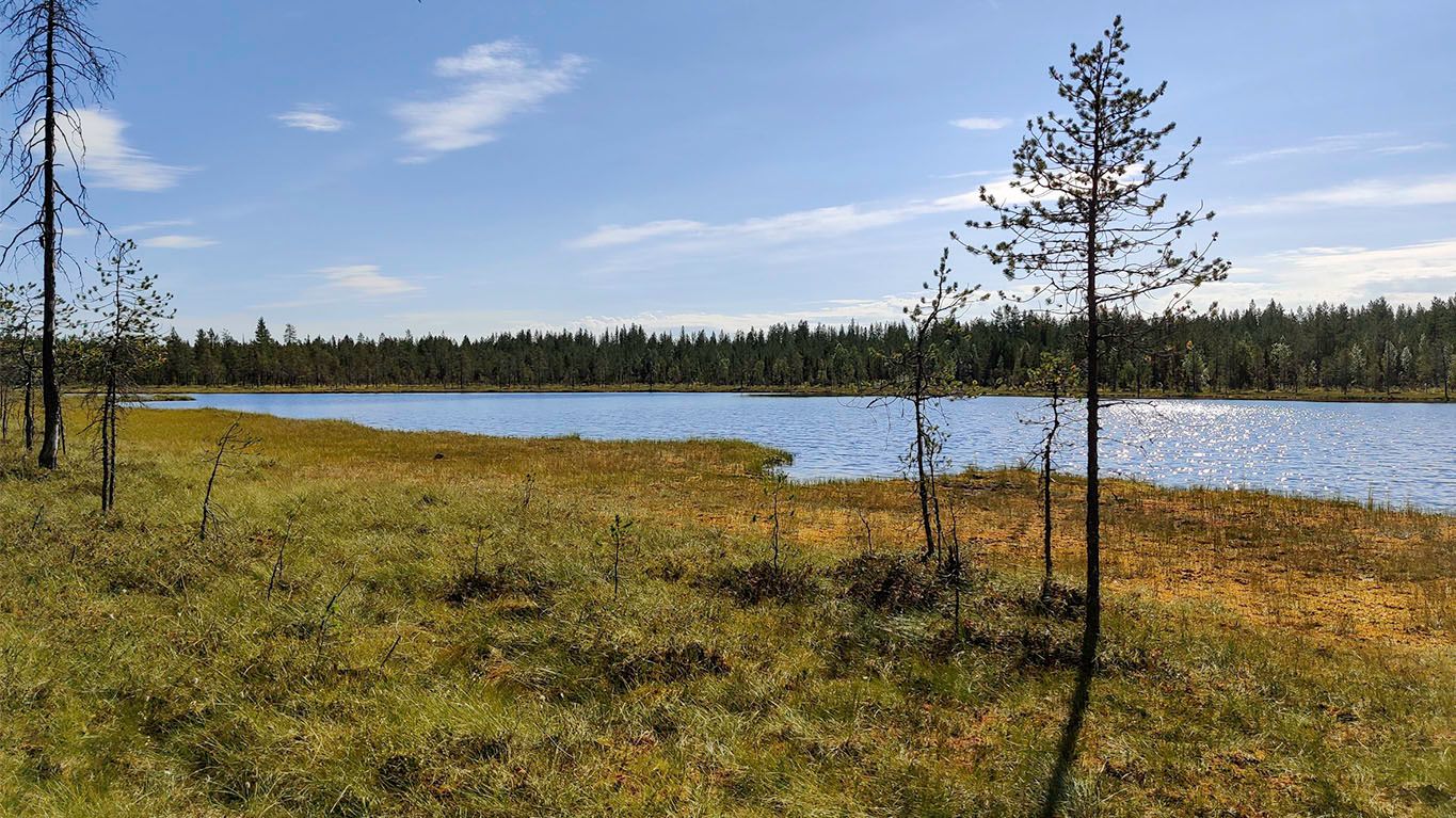
Emerging from the mixed forest, Könkäänlampi pond offered a blissful sight. As far as I could observe, there were no suitable piers or stones from which to dip into the water without risking sinking into the marsh - but it may be that I just didn't notice them. It was too early for a swim after walking only an hour from the Rytiniva campsite.
When arriving at Könkäänlampi, I had to reduce some of the backpacking clothing that I was wearing. At +25C, the few insects were less nuisance than the heat wearing long pants. Switching to shorts made the trek much more bearable.
Lessons learned: When packing layers of clothing, prepare to reduce excess clothing, not just for layering more. Without shorts, I would likely have cut spare pants to make shorts of them.
It's not yet autumn, but the marsh is already showing a magnificent play of colors, from greens to oranges, browns, and reds.
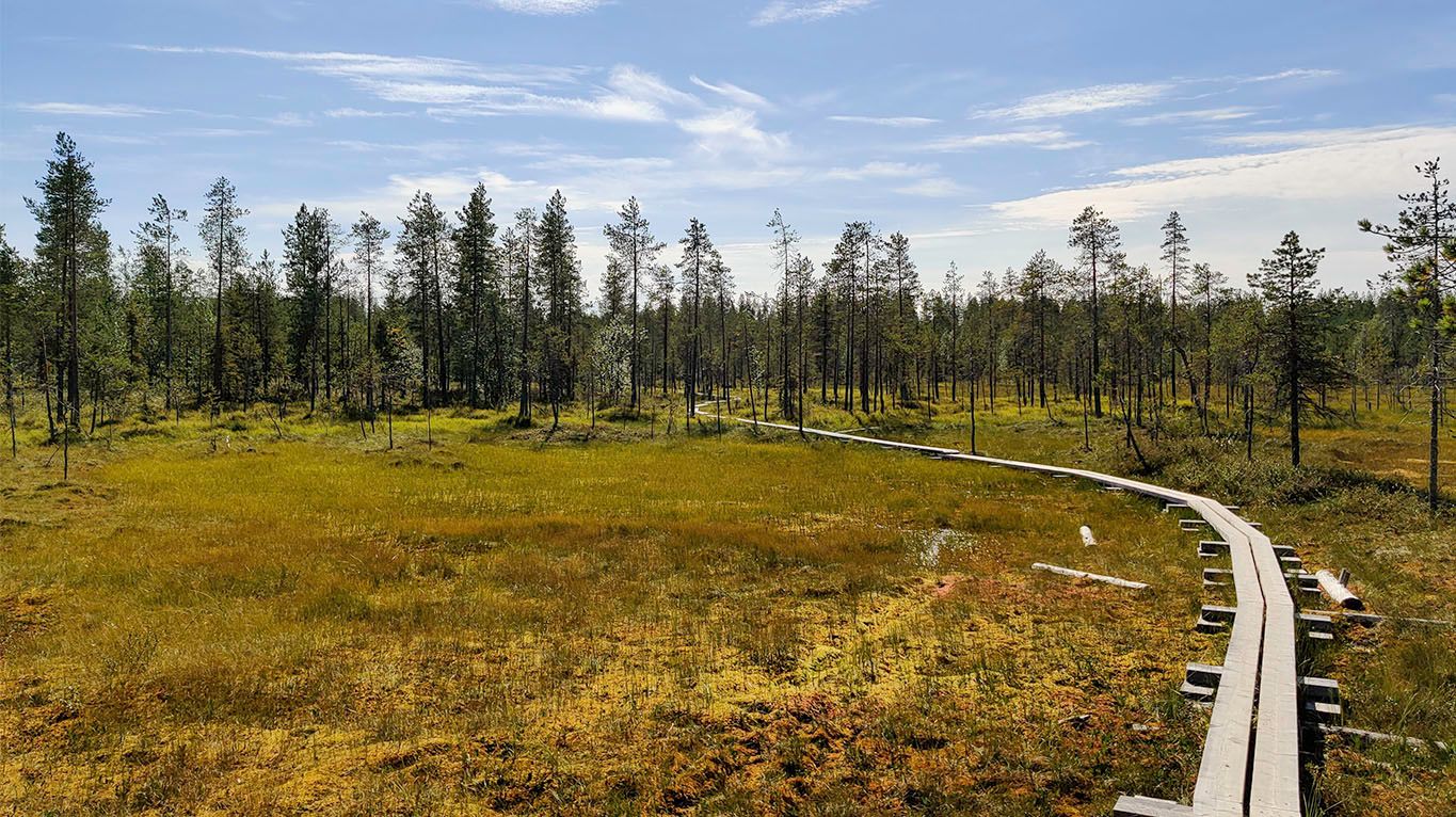
On a bright day, the marvelous greens of the marsh are visible, almost radiant in their sunbathing.
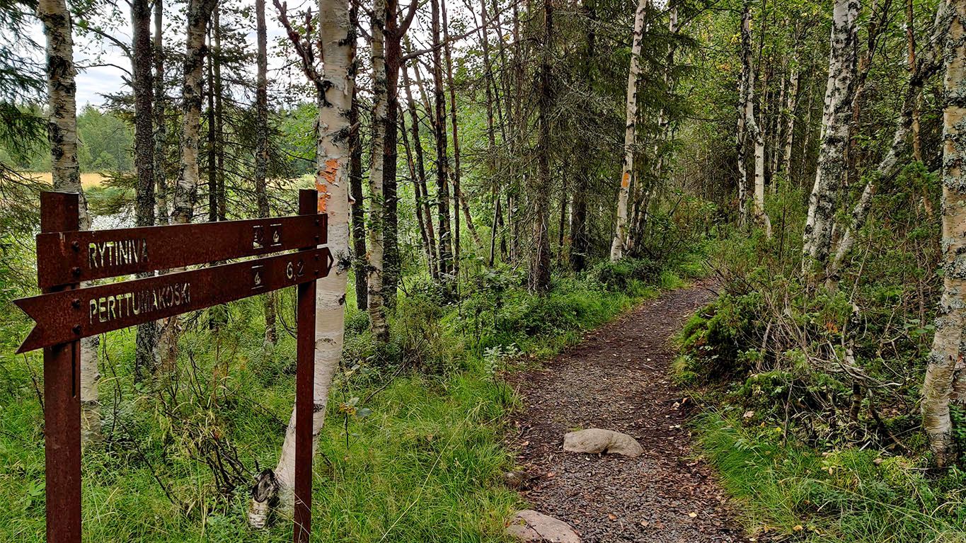
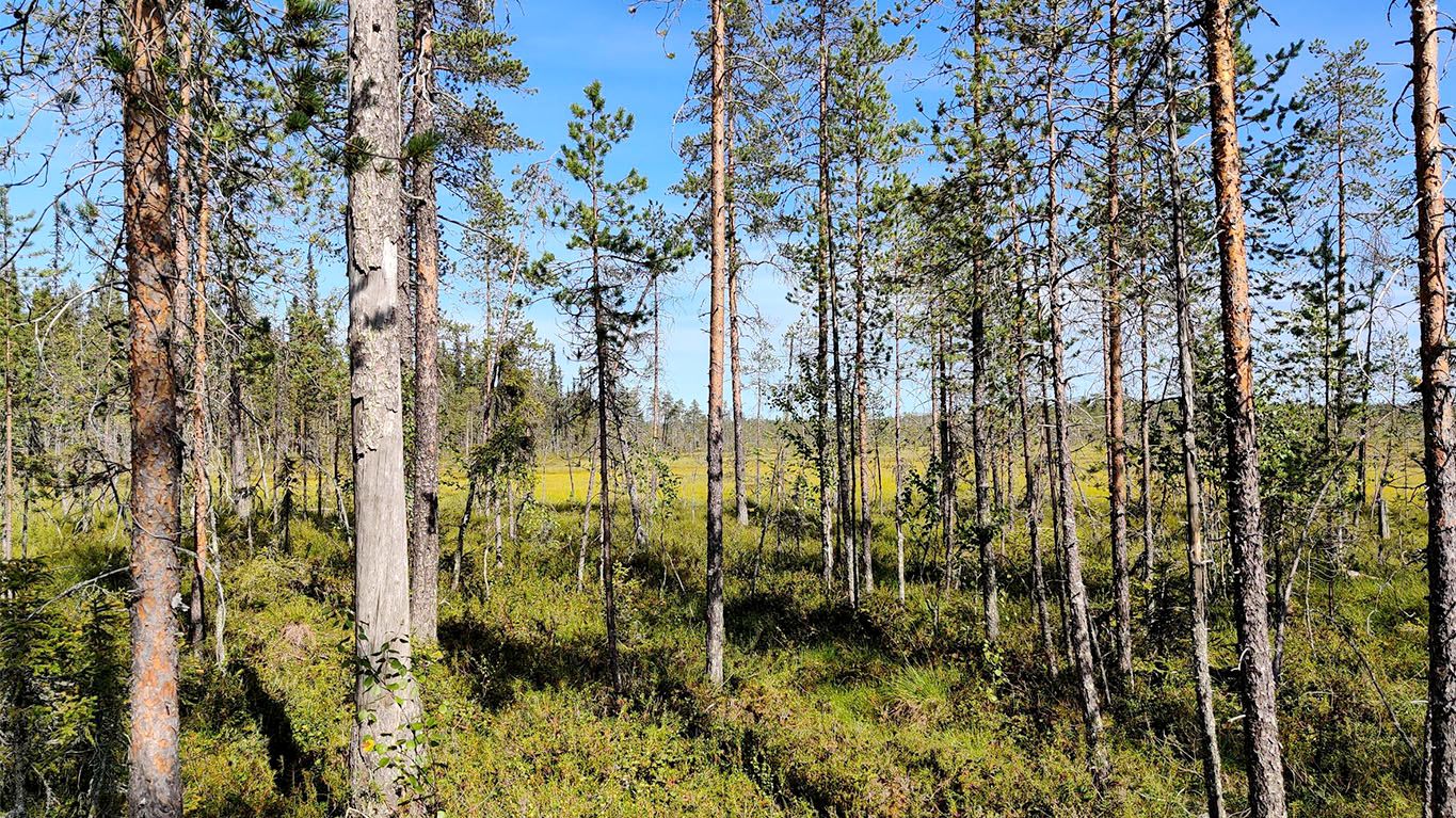
While some of the paths had already felt like a wilderness up to this point, to my surprise, the beginning of the national park was very clearly marked.
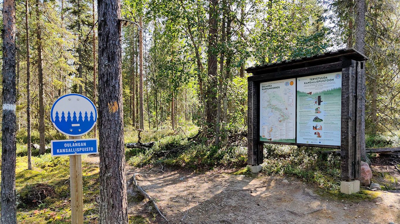
The path this far has been only 4 km long, but there have already been many sights and varied terrain to experience. From hereon onwards, the path would be in the park, without inhabitants living nearby.
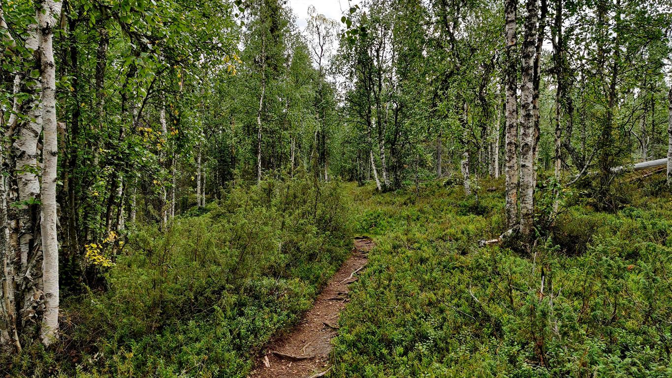
The only immediately noticeable change in scenery was the quality of the path, from a forest path to a gravel path, but that would change soon enough.
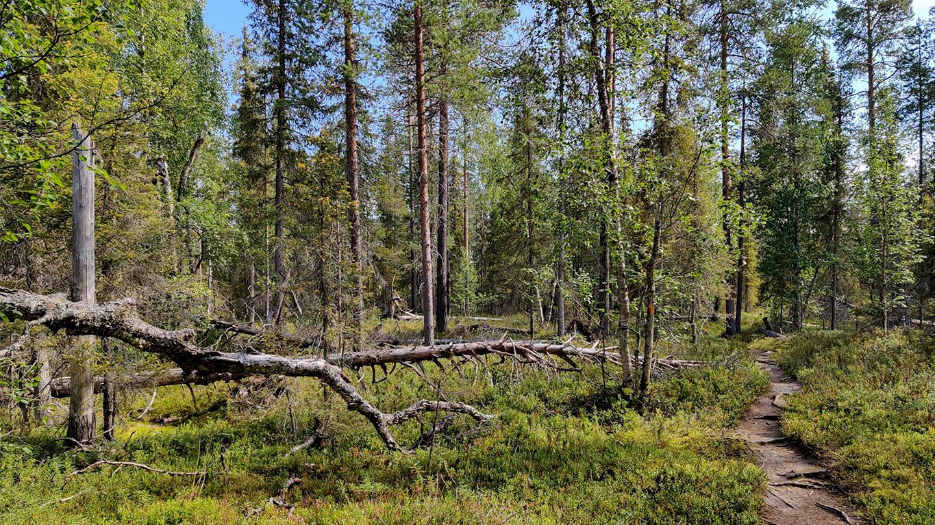
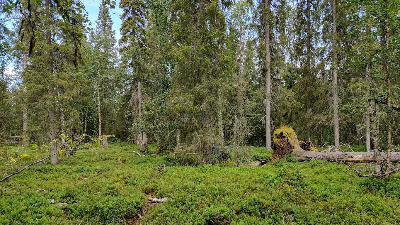
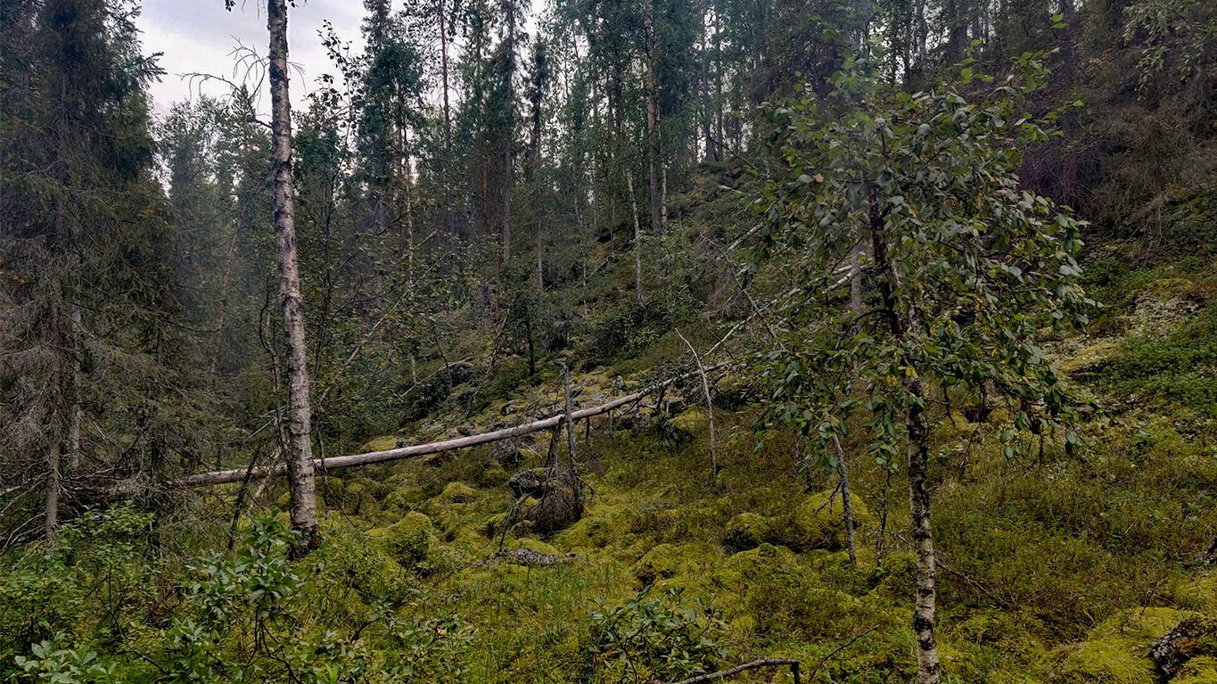
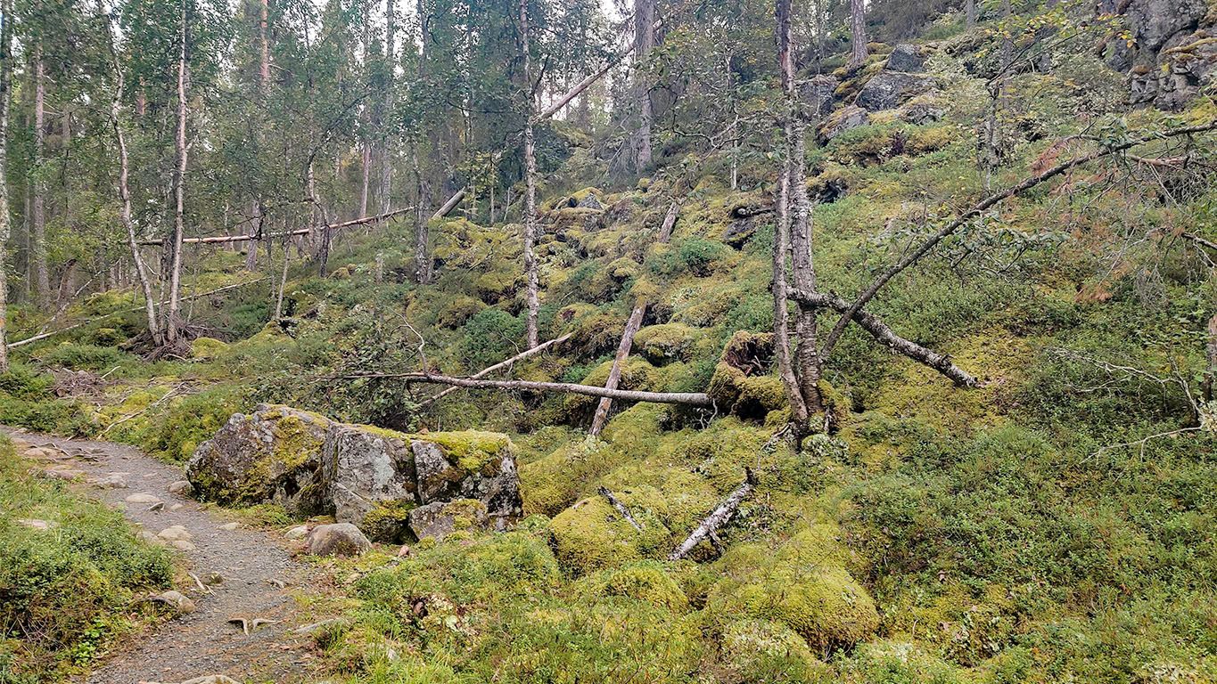
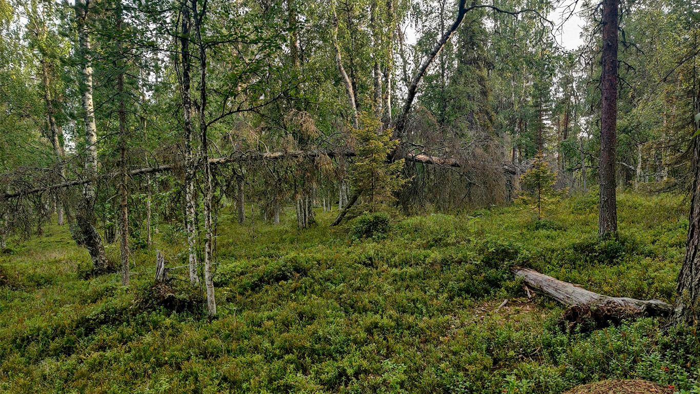
One thing that distinguishes the national park from the previously well-kept forest is that fallen trees have not been cleared. But instead, outside of the path, the forest is in quite a natural state.
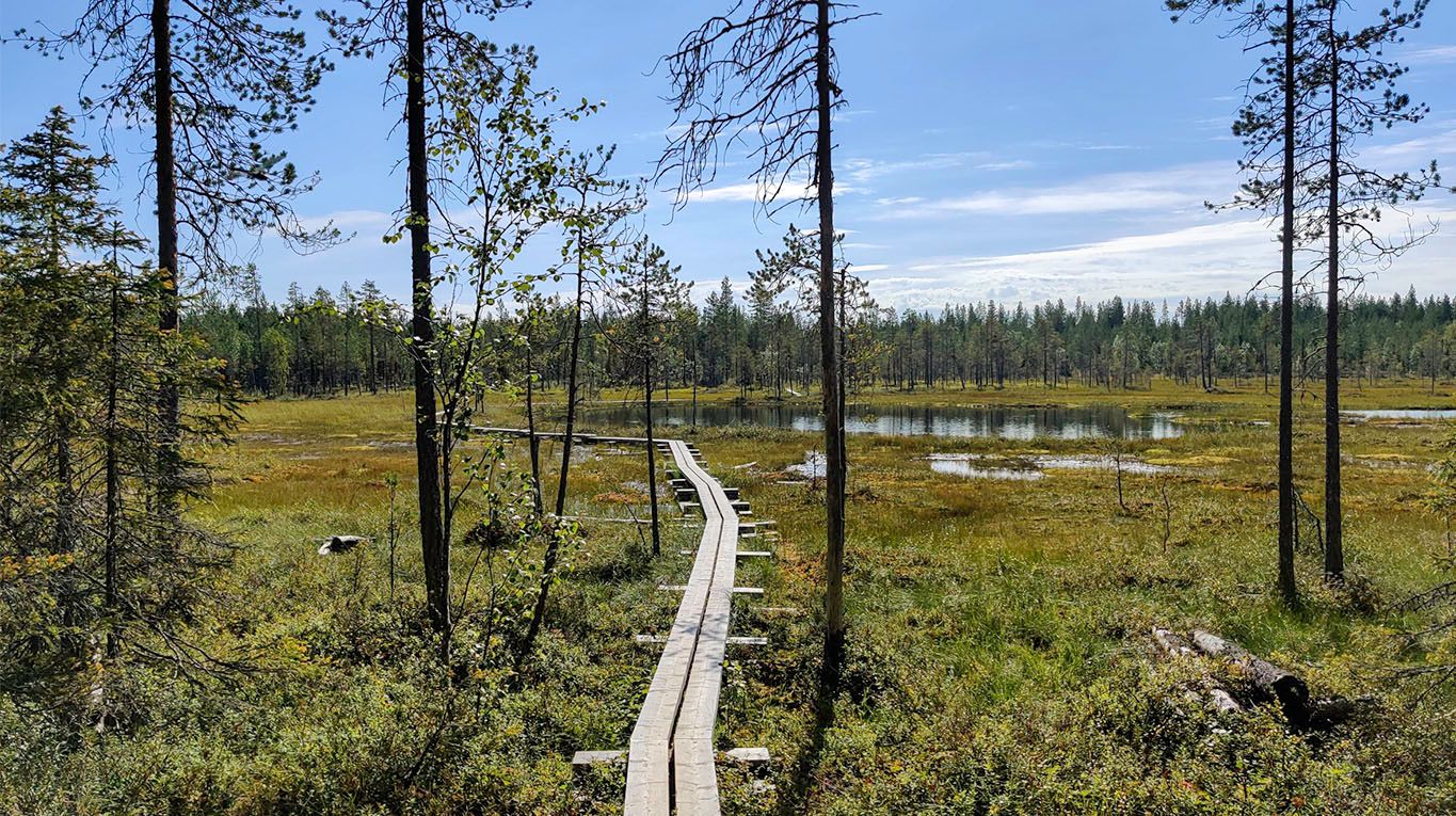
After the marshes, the path slowly starts to climb.
Perttumakoski lean-to
There are no pictures of the Perttumakoski lean-to. So I'll have to describe it in a few words. It's a low shelter, similar to the Vasaoja lean-to below, with wood storage, a table with two benches, and a fireplace. It overlooks the Savinajoki-river, allowing easy access to the flowing water supply.
Considering how many pictures there are today, why are none of the lean-to? It's a lesson learned from the Komoot mobile application. You can take journey photos within the application, but it doesn't store them locally (like a camera does), so when the application fails to upload the photos, the battery runs out, or the application crashes... They're lost.
You would think an outdoor application would be designed to be more resilient to poor connectivity. Losing a portion of the photos is one of my regrets for the journey, but maybe next time, I'll get to complement the photo coverage.
Lesson learned: Take photos with a camera, not with the Komoot application. If you want to share photos within the application to publish the journey, you can add them manually when saving the journey.
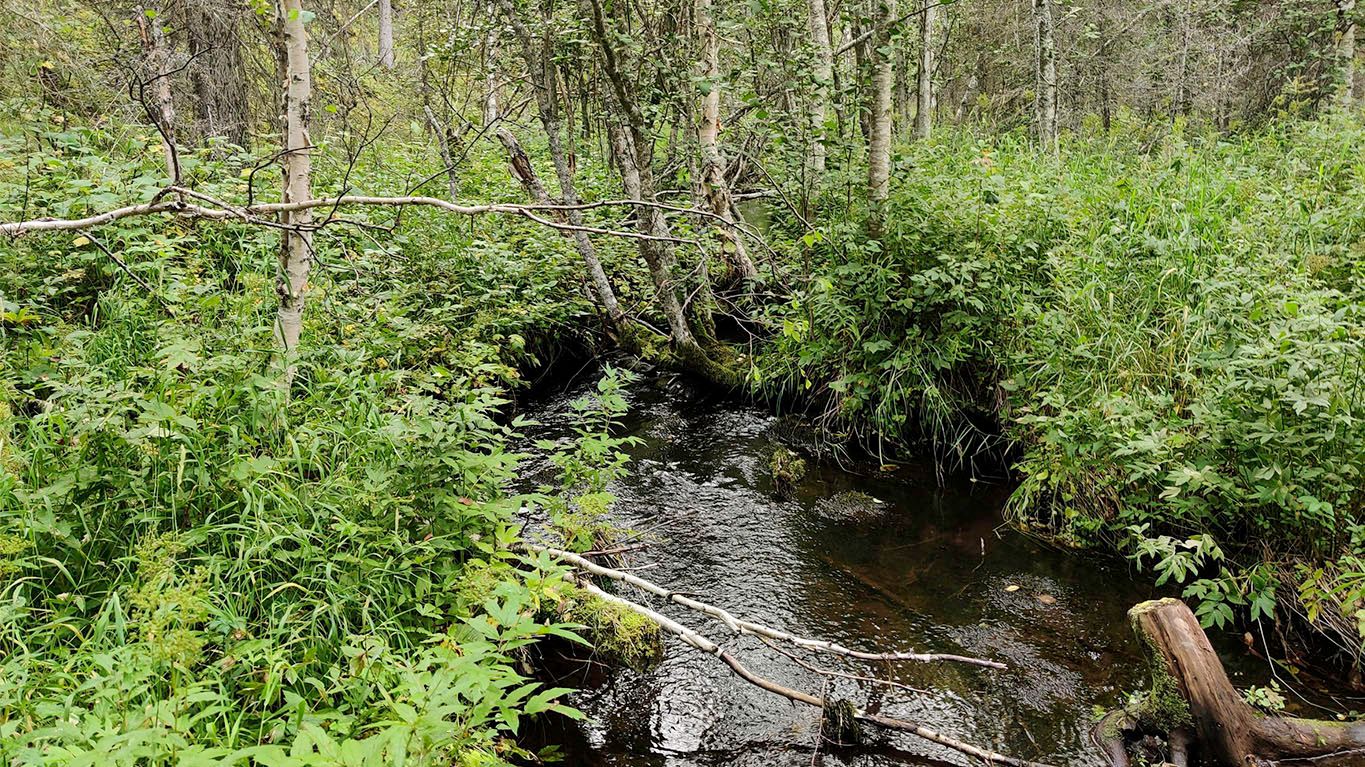
Water is life. The lush forests and green meadows prosper in the vicinity of the Perttumakoski river.
Besides the vibrant life in the vicinity of the river, the fact that this is a national park is emphasized by how the forest grows wild. Fallen trees have not been removed but instead, act as a platform from which new life springs.
Below is a short video about the Perttumakoski river flow on the Karhunkierros backpacking trail. Taken on Monday, 15.8.2022, at 12:50 in the afternoon. Location: 66°29'33" N 29°10'5" E.
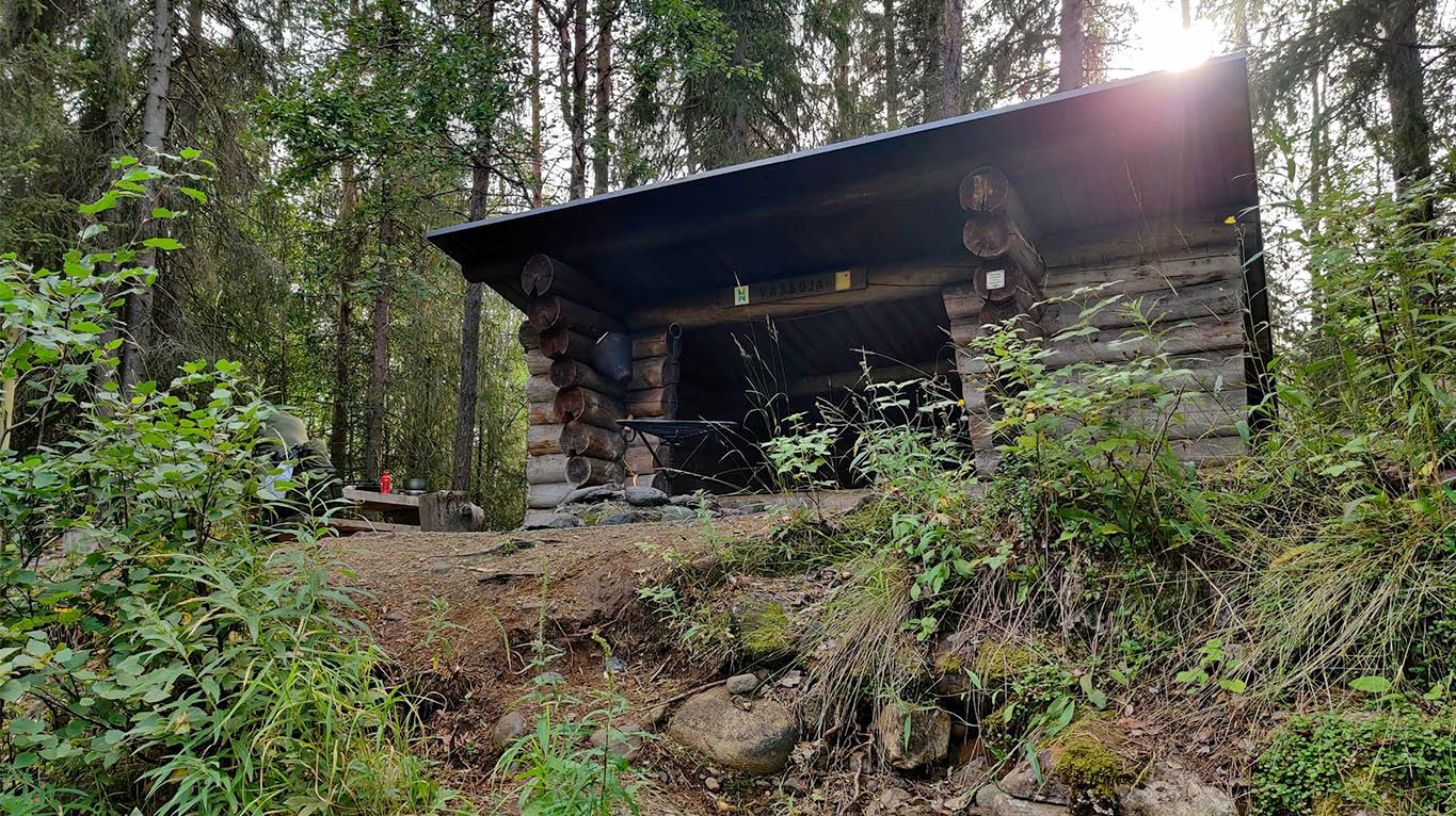
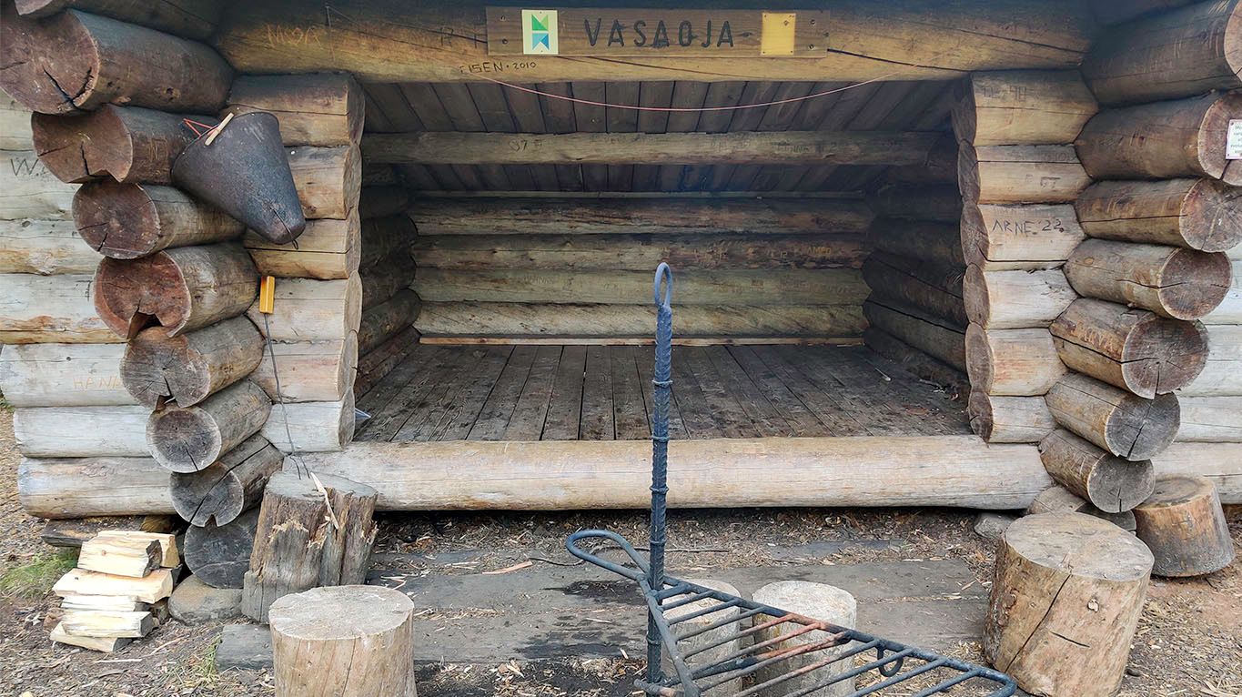
Vasaoja lean-to
The Vasaoja lean-to isn't visible from the main Karhunkierros path, but instead, you need to venture downhill for some 200 meters, but it's worth it.
The Vasaoja lean-to sits on top of a beach embankment, maybe 1,5-2 meters higher than the river rapids below. In dry weather, it's easy to traverse, but if there's rain, the slight slope might become somewhat harder to climb.
The spot is suitable for refilling water, with a water filter-purifier, with access to the water's edge.
Trap fishing at Oulanka national park area requires a fishing permit and is allowed only between June and August (1.6.-31.8.2022). For more information and on purchasing the permit, visit the Eräluvat agency. I don't trap fish, so I can't add more information on the topic.
The Savinajoki river flow grows stronger with whitewater at Vasaoja.
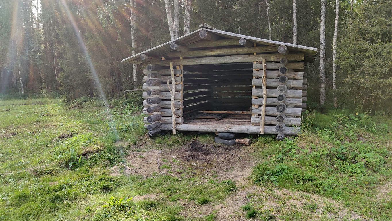
The lean-to's, called "laavu" in Finnish, have room to allow 4-5 persons to sleep side by side in sleeping bags. Well sheltered from the weather, but with one side open. In the photo below, you can also see a part of the fireplace and also, importantly, a bucket for quenching the fire with water from the river.
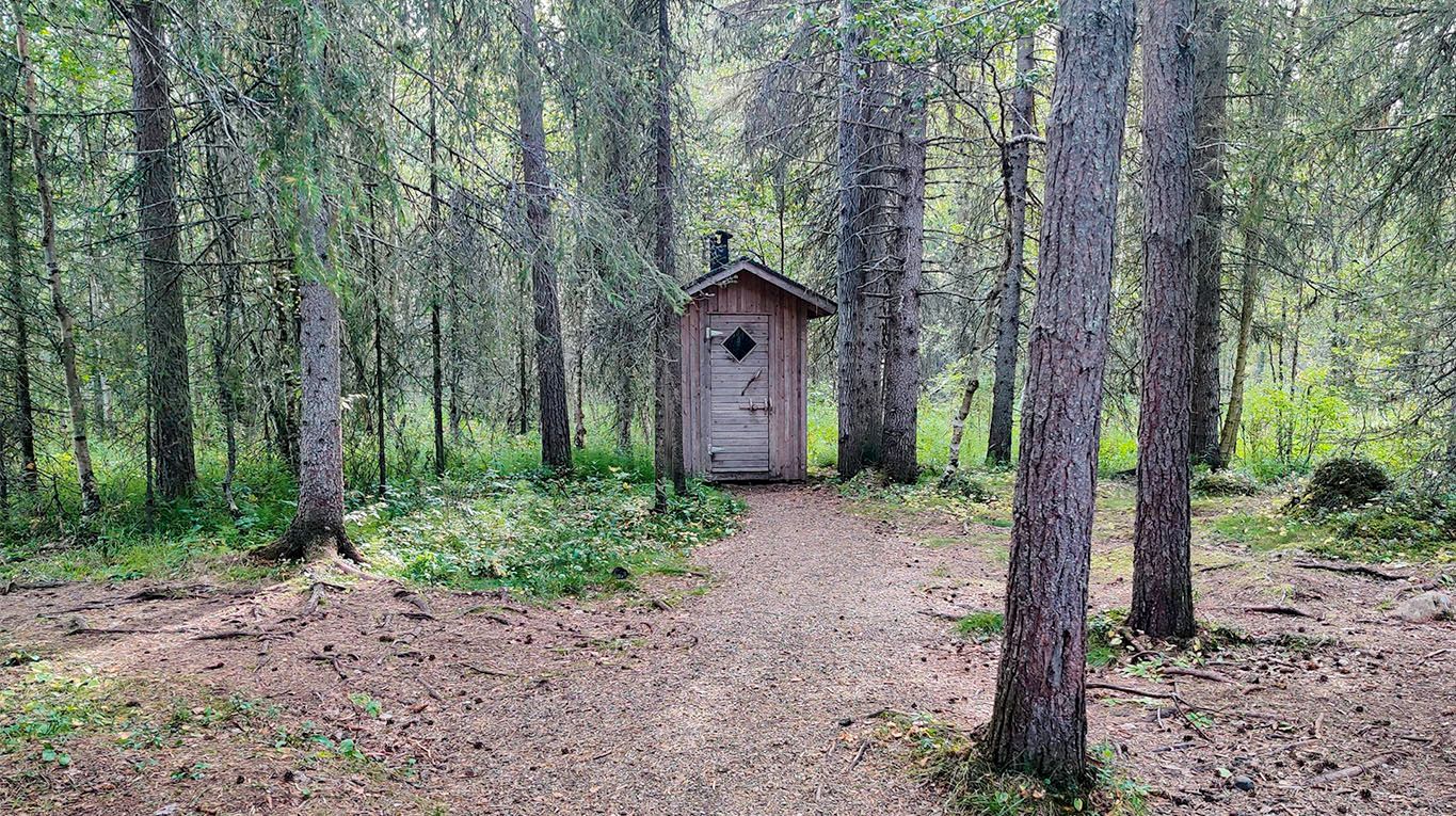
Each of the lean-to's and campsites on the trail have (relatively) comfortable amenities, like outdoor toilets called "huussi", "ulko WC" or "puucee" in Finnish. Remember to bring your own toilet paper rolls, however.
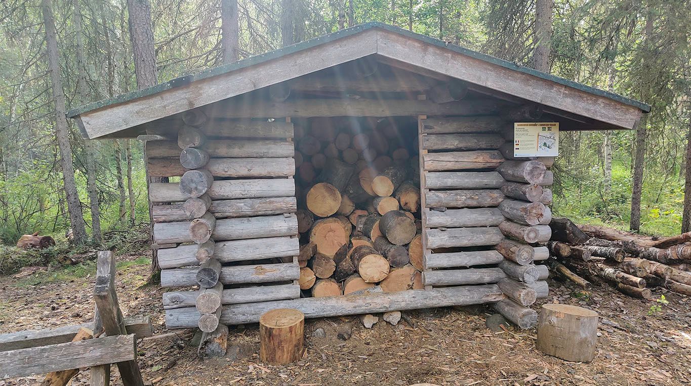
Another example of the great amenities provided is the national park. At least during my visit, all the wood storage was well stocked and available for use by the visitors, free of charge.
The size of the logs makes you wish you brought your saw and/or axe, doesn't it? They are not provided, and I assume would be lost too frequently.
Assuming you brought your gas or alcohol camp stove, firewood is needed more for the atmosphere or warmth in more extended stays anyway.
The second lean-to is maybe 50 meters from the first one. A slightly more roomy version with walls ensures that fresh air flows freely.
Next to the second lean-to, on an expansive grass field, there is a lot of room for tents, with the necessary amenities nearby.
Lessons learned: If you would arrive in a bus full of other backpackers and there's enough light, I'd consider aiming for the Vasaoja campsite, though it is 12km away. Where Rytiniva and Perttumakoski could each house less than ten people, there is enough room at Vasaoja lean-to more than thirty people.
The second fireplace is roomier but doesn't have a table like the first one.
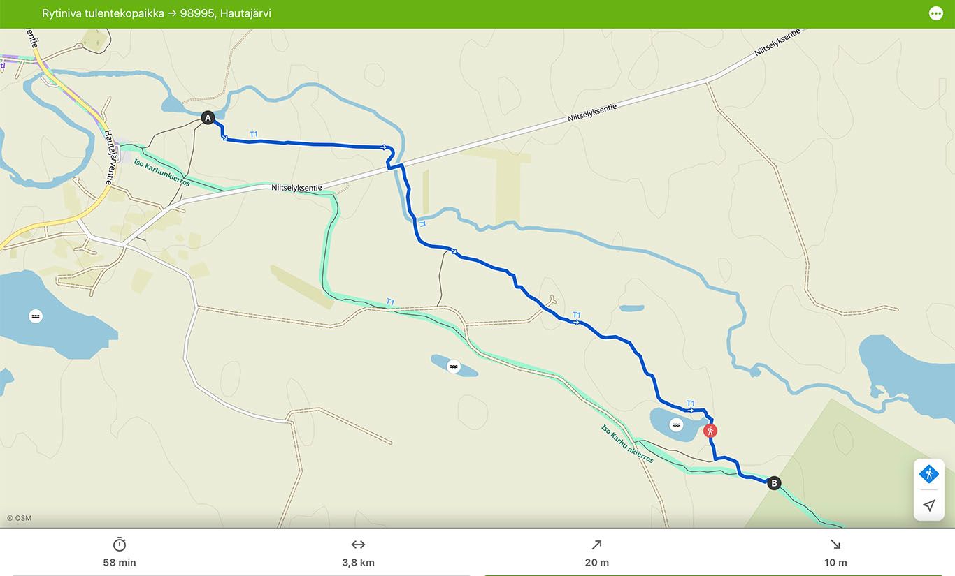
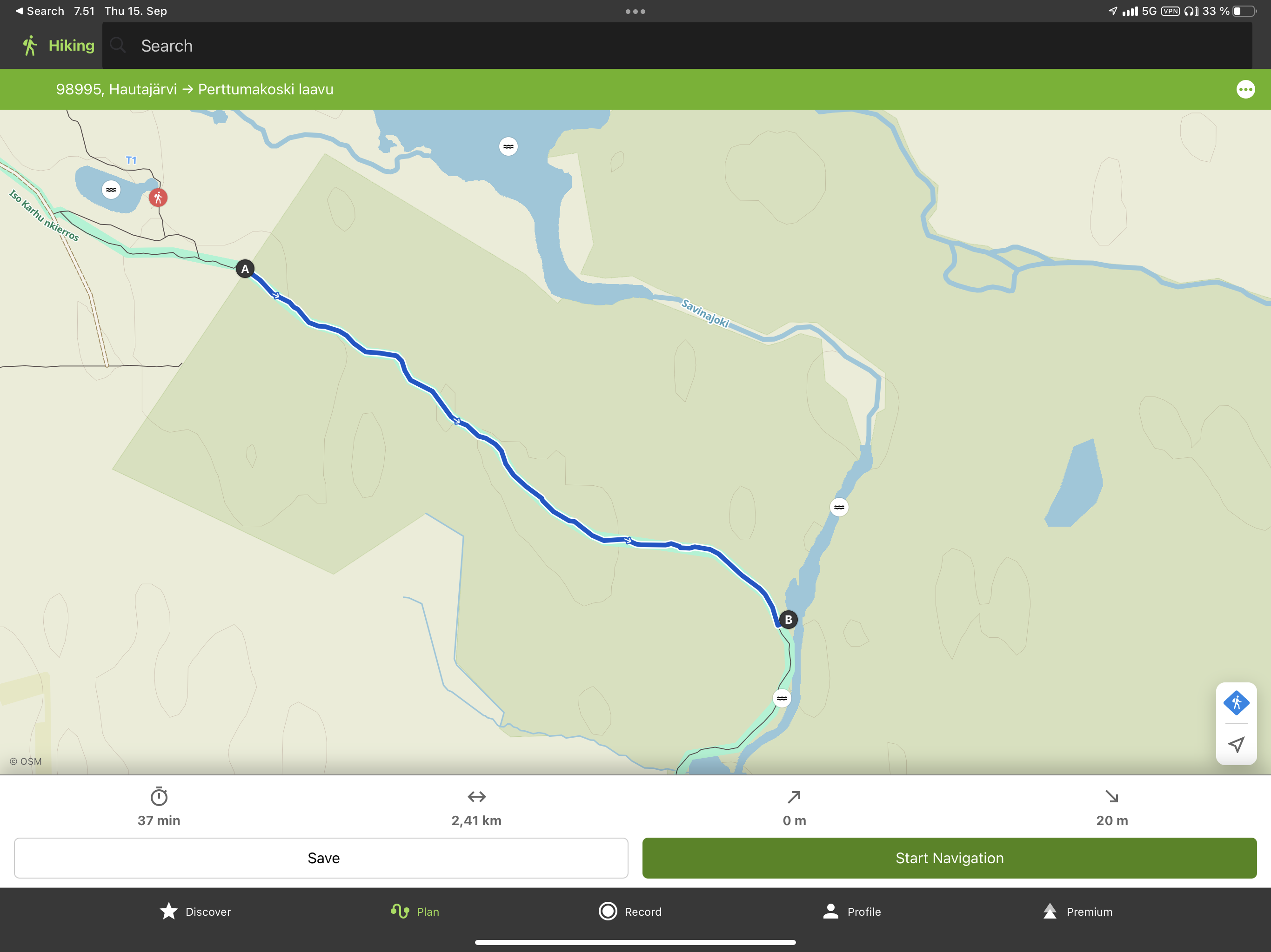
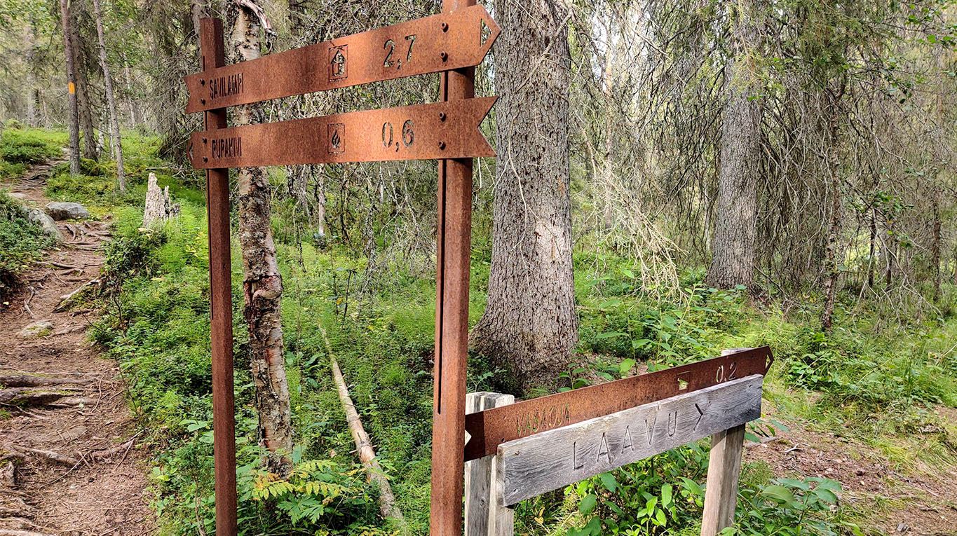
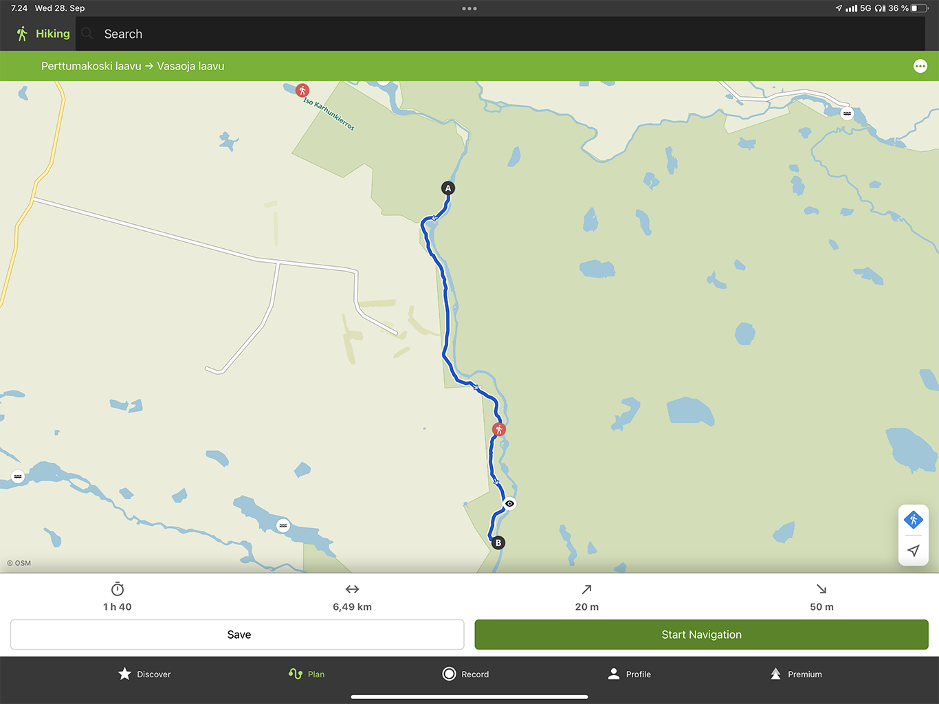
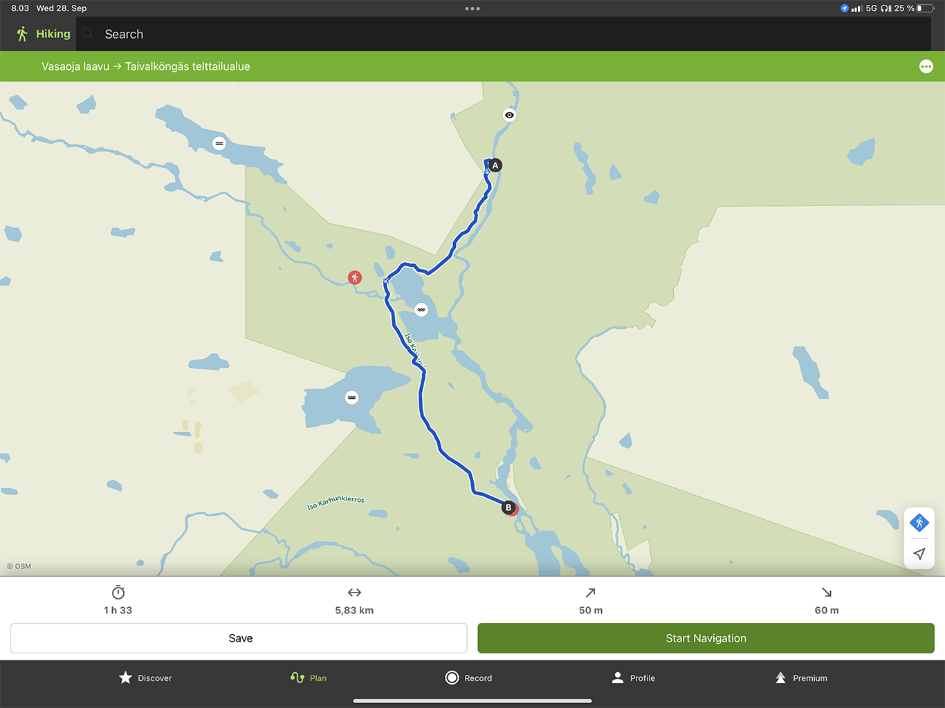
The trail between the Perttumakoski and Vasaoja-laavu is summarized on the map below. The time estimation of 1h 40minutes is an estimation from the Komoot software. For me personally, it took longer at 2h 40 minutes - but that time contains several factors affecting speed (listed at the end of this article).
Lessons learned: The lean-to's in the Karhunkierros trail is around 6km apart. It makes sense to plan the stops for them for a moment's rest from carrying the gear and eating.
Continuing the journey, back up the sloped path from the Vasaoja campsite.
A perfect spot to fill the carried water supply, clear flowing fresh water. Very conveniently located by the path. For the note, I still used a water filter-purifier that doesn't change the taste of the water.
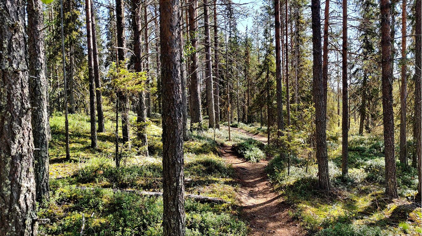
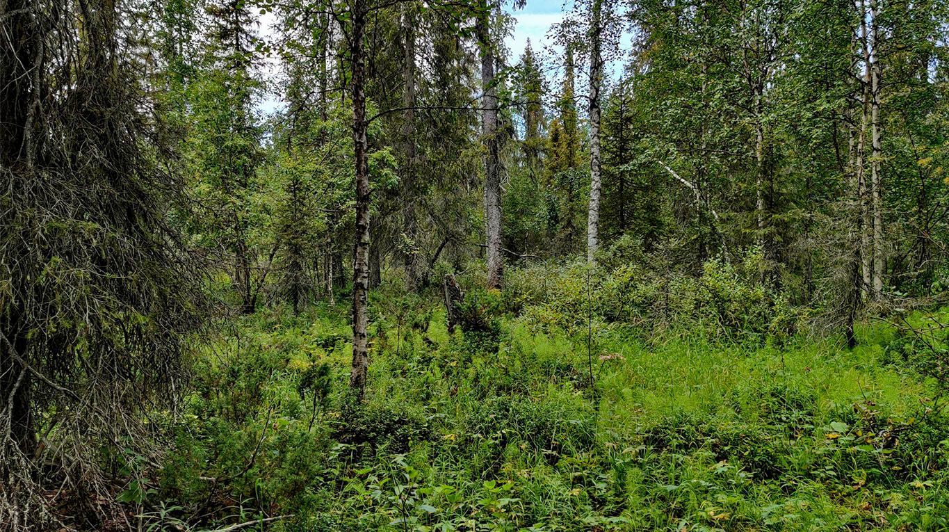
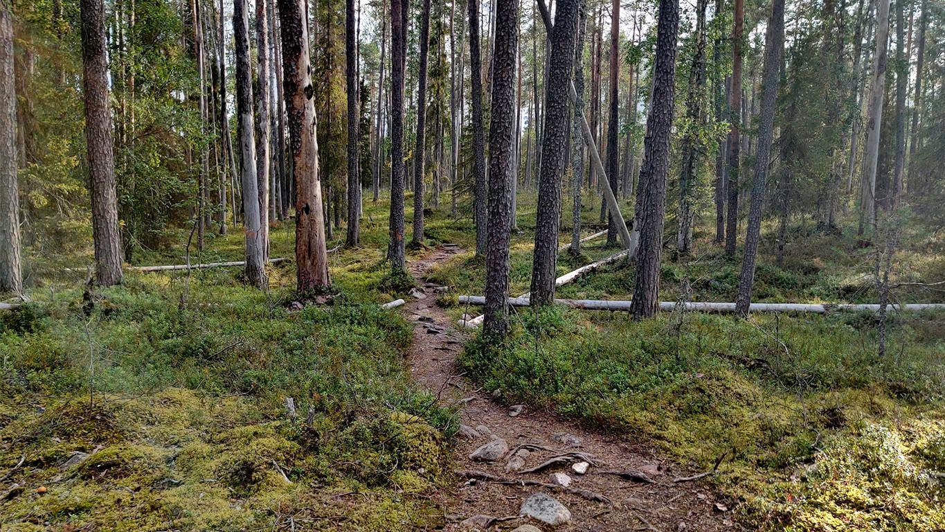
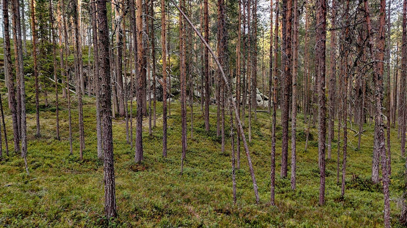
The moist forest soon changes to a drier, softer area where moss is the predominant feature, covering all the rocks, pebbles, and fallen tree trunks.
The scenery changes again shortly after to a pine forest with a thick, soft heath floor.
After traveling alone in the forest for a while, you start to notice subtle details, like how the forest floor consists of patches of various shades of green, depending on the dominant plant in that small area, from blueberry to lingonberry, and from mosses to grasses.
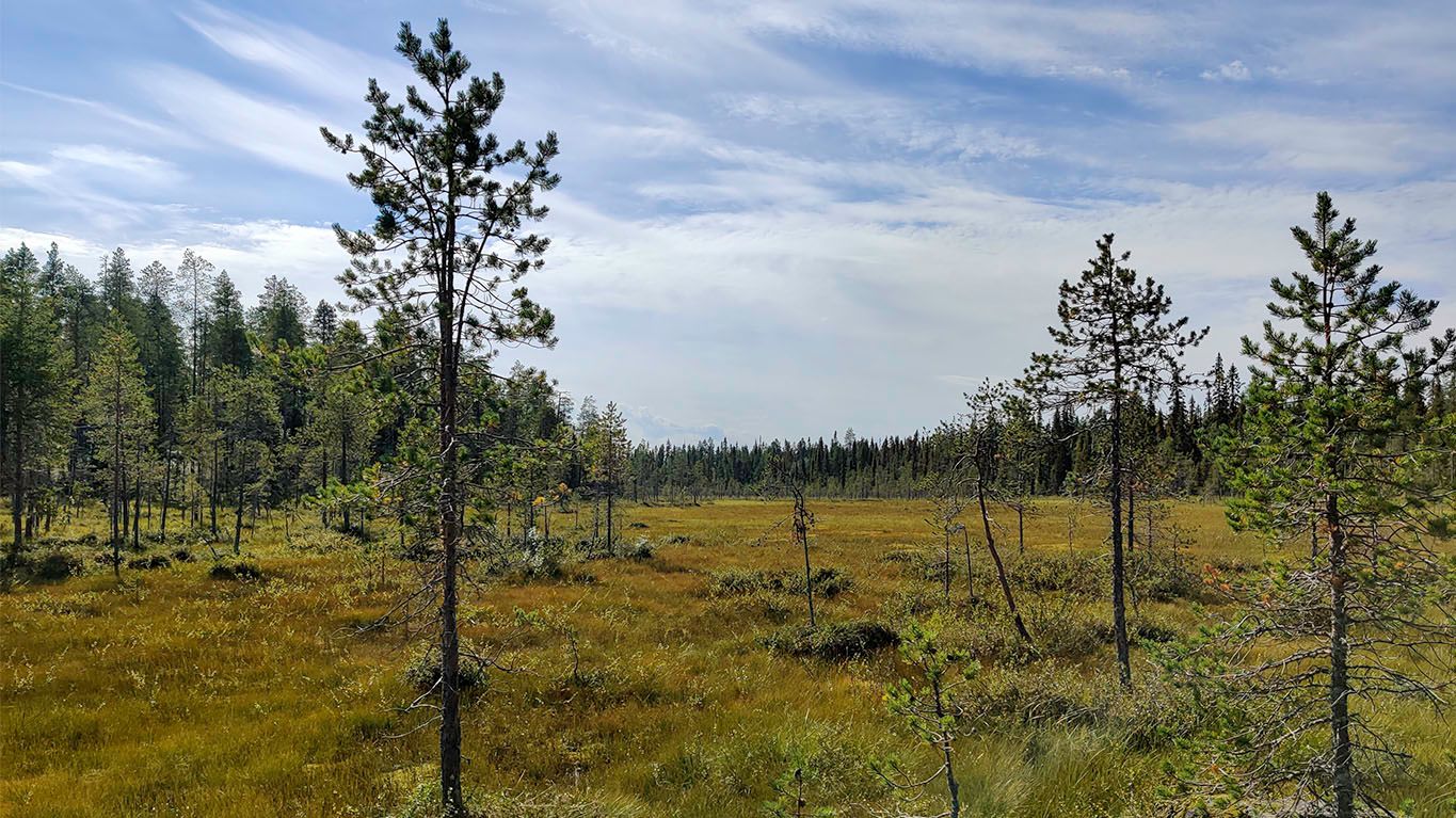
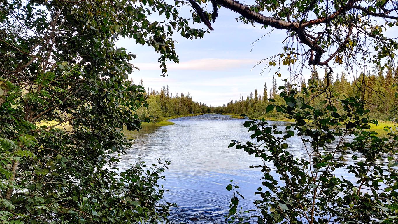
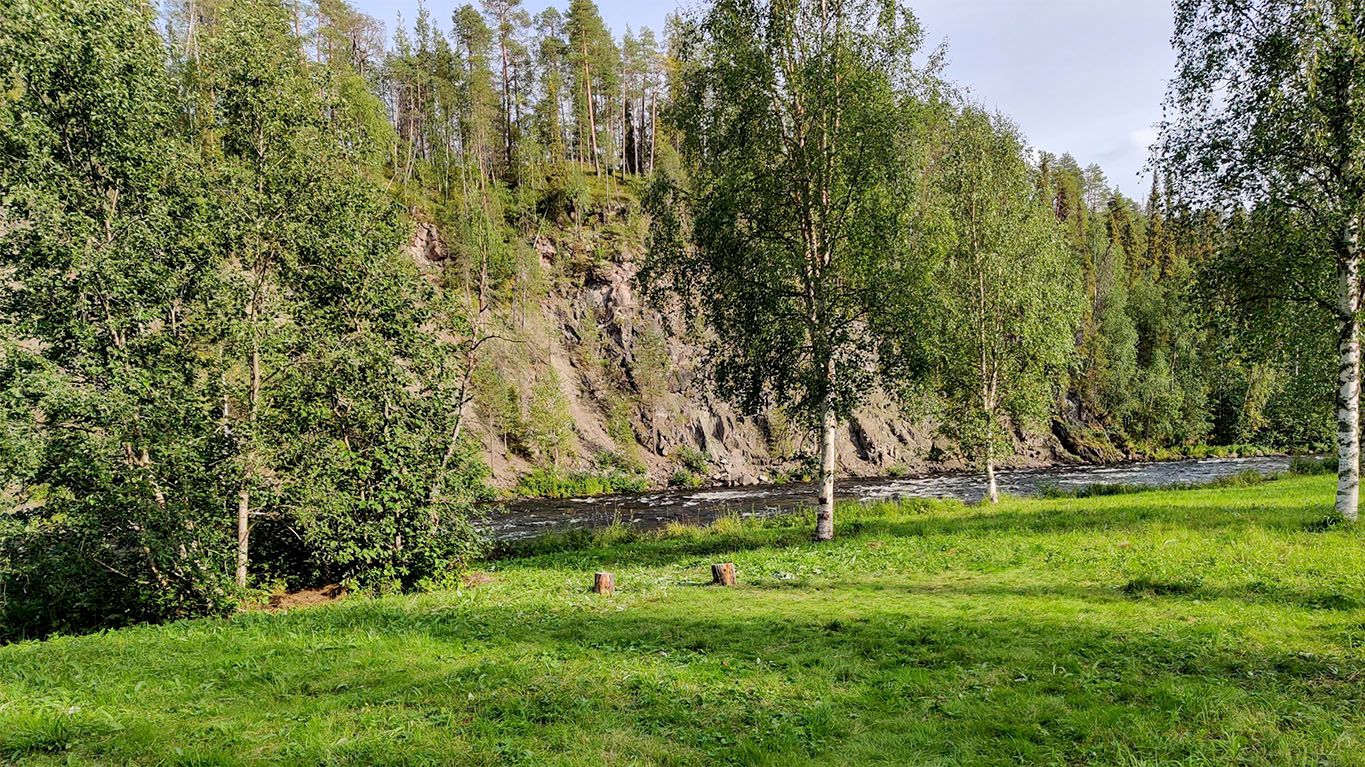
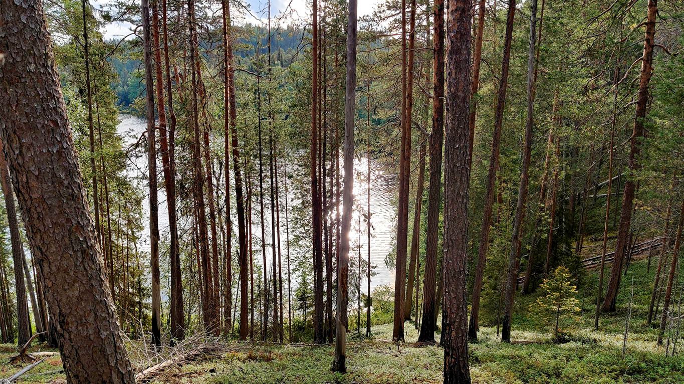
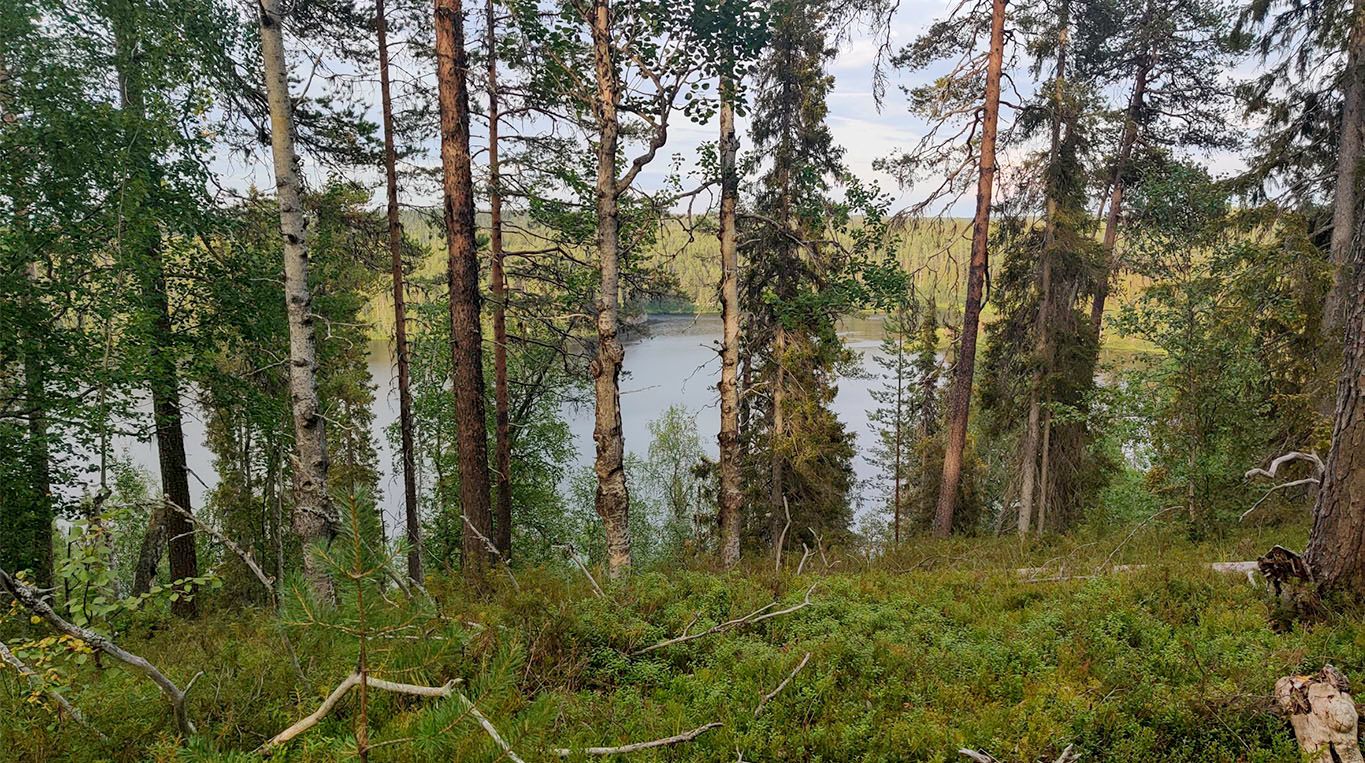
Towards Taivalköngäs, the elevation starts to become more pronounced, with sparsely growing pines. Behind the river, what was previously Savinajoki has widened into Oulankajoki, which appears almost like a lake.
I should have taken a swim here but didn't, as I wanted to push forward to reach the Taivalköngäs campsite. This would have been perfect.
Lesson learned: If it's warm enough (maybe even if it isn't), take the opportunity for a swim at least daily or preferably more. There are no guarantees that suitable places are available in the next half a day's travel.
In the first leg of the journey, water is plentiful from rivers and streams.
Lessons learned: In Karhunkierros, the water in streams, ponds, and lakes are quite clear (except for some of the marshes), and there isn't much need for filtering the water. Even with water that visually appears pure, I'd still advocate for purifying (via a purifier, cooking, etc). the water to be on the safe side.
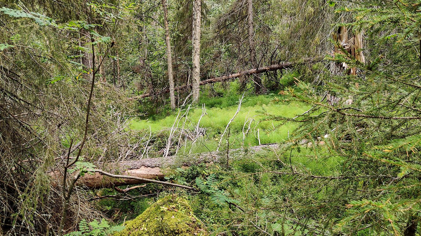
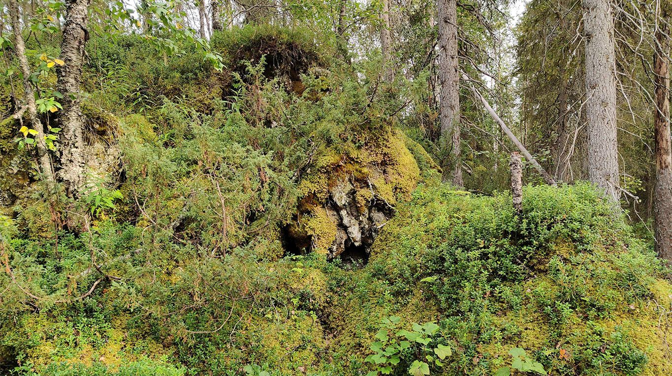
An exciting area, with a forest opening into a steep slope of rocks, boulders, and pebbles, all covered in a thick layer of moss.
The slope pictured below is an interesting one as if there had been a pile of relatively roundish stones that had rolled down the hill like water and then stopped in their place and grown a thick layer of green moss.
Savilampi campsite
Like with the Perttumakoski lean-to, there are no images of the Savilampi campsite due to them being lost from the Komoot application. The campsite has room for several tents, a couple of fireplaces, firewood, and a lean-to.
On maps (e.g. Google maps), the campsite can also be found as "Savilammen autiotupa" (66.432, 29.156).
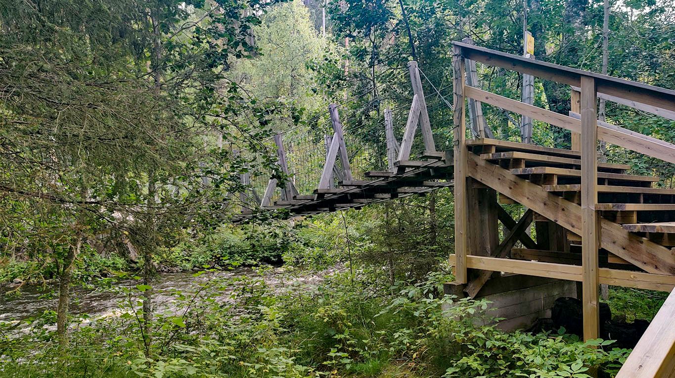
The rope bridges on the trail are sturdy, with railings and low points of gravity, making them very stable.
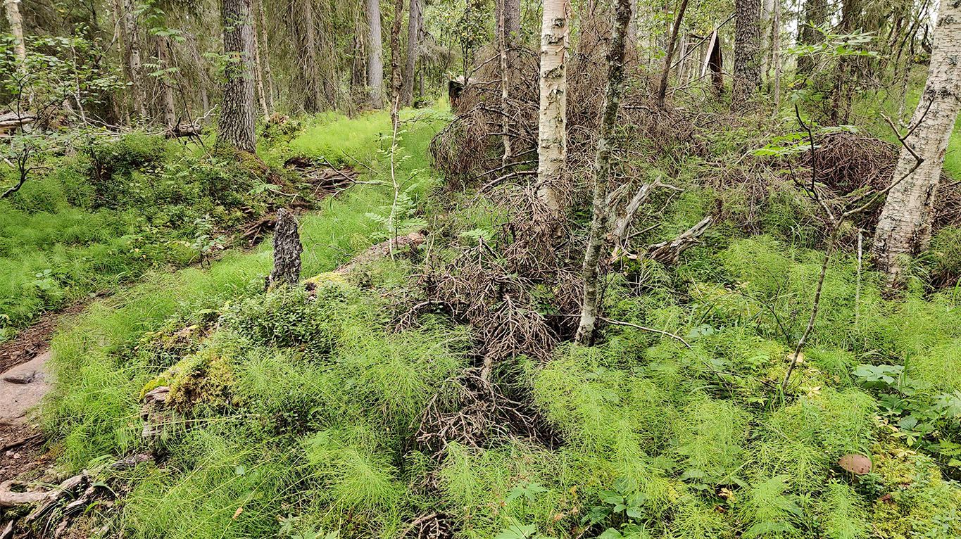
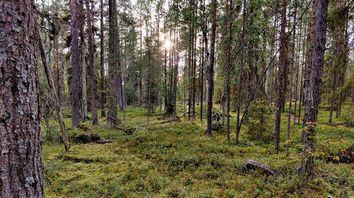
After the Sarvisuvanto river, the landscape changes into somehow very clearly grown forest. The trees are far apart, all of the ground is covered in very thick heath, and the worn path snakes a brown river through the green land.
In the fall, these areas might grow a lot of edible blueberries and lingonberries ripe for picking.
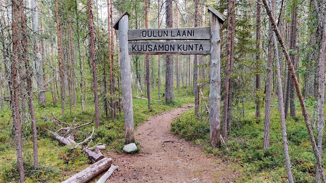
Crossing the municipality, from Salla to Kuusamo, within the Oulu province.
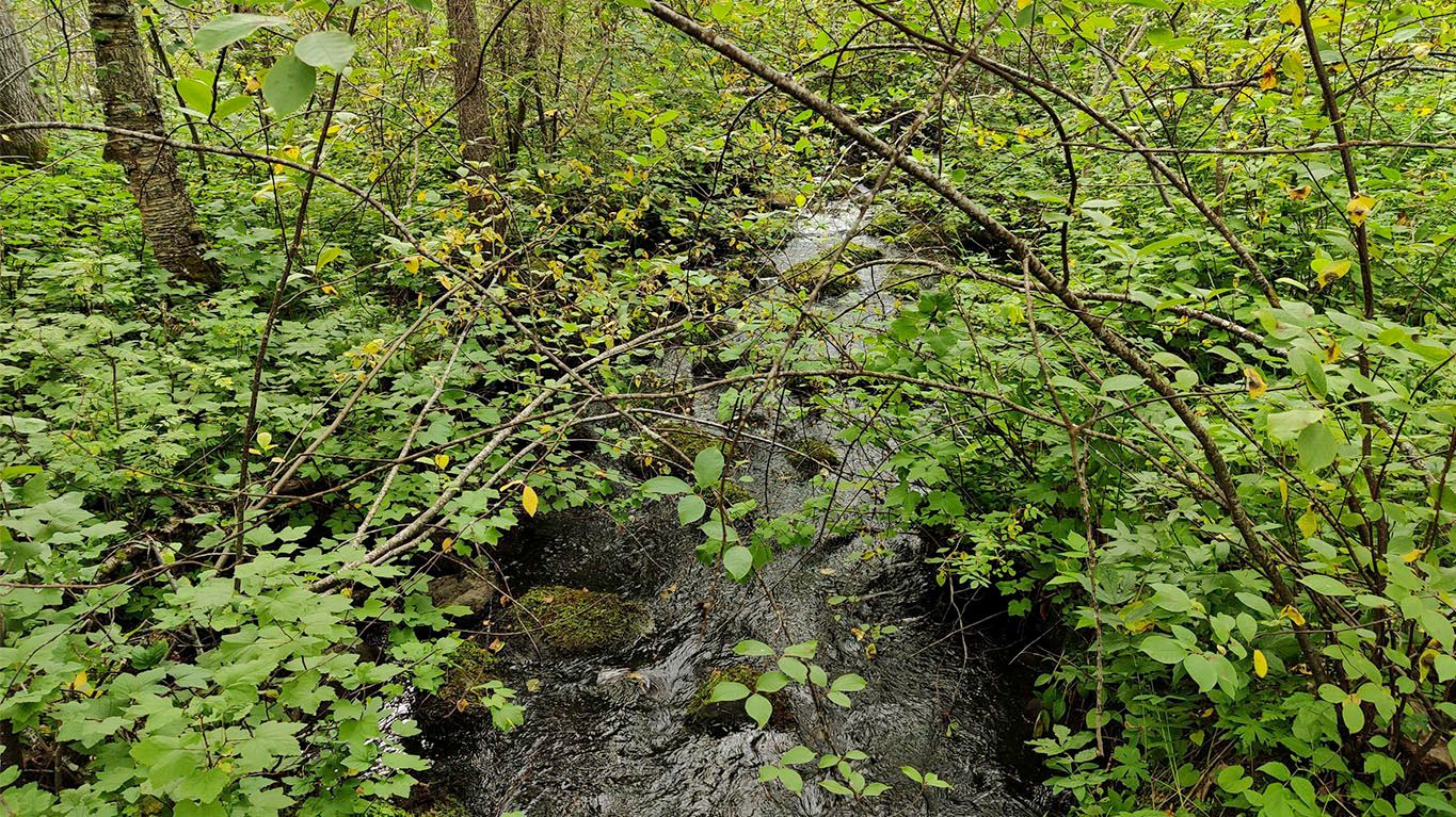
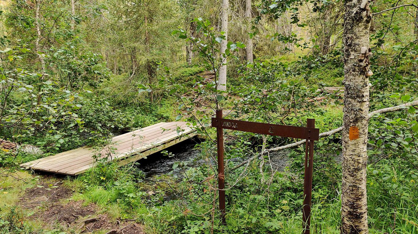
An opportunity to refill carried water, as at Puikko-Oja, which could be translated to "Stick-ditch". I was delighted, that there was a plank bridge so I wouldn't need to dip my shoes into the water just before the camp. By the looks of it, when the snow melts in the spring, it might be reasonable to carry a pair of boots to the trail.
Lessons learned: In Karhunkierros trail, like all of Lapland if you're backpacking when the snow has recently melted, such as in June, the streams are likely to overflow.
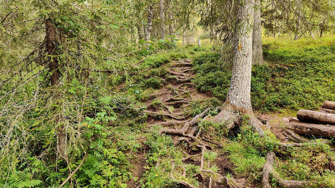
While not rugged terrain, as defined in having to climb rocks, the uneven ground on the path requires focus and attention on where you put your feet so you don't stumble.
After the uneven terrain, a delightful span of a comfortable path where the trail was as easy as a trail can be.
The forest just before the Taivalköngäs campsite is so orderly and clear cut that it feels like it could have been a commercial/planted forest before being converted into a national park. Nevertheless, it is a welcome respite at the end of a long day.
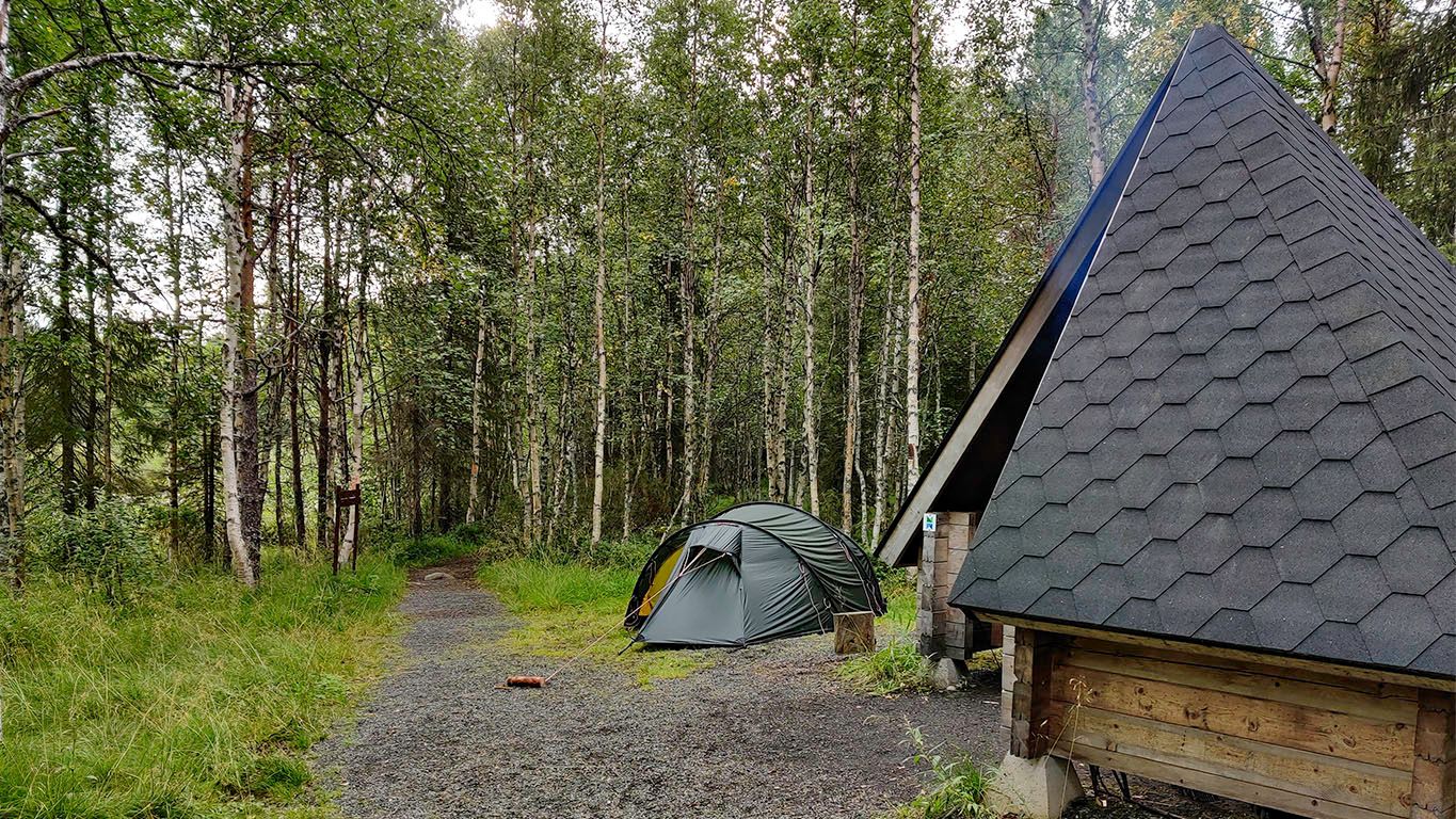
Taivalköngäs campsite
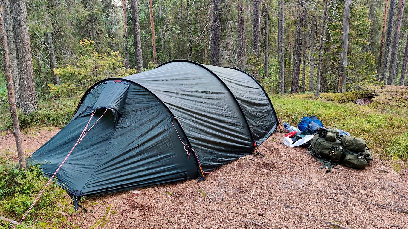
Finally arriving at Taivalköngäs campsite, I erected the tent on the last large enough spot available that wouldn't intrude needlessly close to other campers. As the sounds carry through the tents unhindered, I choose to leave 5+ meters between tents whenever possible.
At half past eight in the evening, I was the second last to arrive at the site. There were already around ten tents erected (accompanied by nearly 20 people), but as commented earlier, it is a design decision at this site to leave the people out from the images.
For reference, you can find a for the last leg of the day's journey, from Vasaoja lean-to to Taivalköngäs campsite. Again, for me personally, it took around one-half longer at 2h 10min.
Insights from the trip of the day
In addition to the lessons learned notes above, below are some personal insights that span the whole day. Note that these are as a beginning backpacker, if you're more experienced, you likely already have established better practices.
- Plan to stop every 6 kilometers, with the lean-to's conveniently placed for this. During the pause, unload the gear carried and take the opportunity to rest without hurrying.
- Plan for four meals a day. Breakfast before starting on the trail, two lunches during the trail, and dinner at the end of the day. By a meal, I mean actual food, like travel rations.
- If you plan to pause at the lean-to's, the first meals happen conveniently at around every third of the planned 20km per day of travel.
- Some backpackers seem to like porridge for breakfast, it's convenient due to its lightweight, high fiber composition, and fulfilling feeling. I don't. It has minimal energy, and I found that a dry/dehydrated ration worked much better for my energy levels.
On the rate of walking compared to the hiking estimates
My travel times were much slower than the estimates given by Komoot, it's wise to account for your speed in planning for the day's travel objectives. Before the trip, we had planned for 20km per day without knowing the terrain.
During the rehearsals, my walking speed was around 7 km per day in my home city of Hämeenlinna. So 3 hours of walking for 20km and then enjoying nature the rest of the day, right? Wrong. This 1st day's walk was approximately 8 hours from leaving camp at Rytiniva to arriving at Taivalköngäs. Starting from the North, the first day is also the easiest leg of the journey based on the terrain.
The main reasons impacting my speed are listed below, not as excuses but as suggestions when estimating your daily travel objectives.
- I carried a much heavier gear than the typical 20 kg suggested amount. At 28 kg +2 kg of water. Then again, what are averages anyway - what is an average backpacker like?
- I approached the trip mindfully, enjoying nature, not making a deliberate pace from one milestone to the next (as hikers seem to do)
- I took many photos, not deliberate setups with tripods and all, but still around 200 per day, so that might have added some time to the duration.
- The meal stops were relatively short, cooking water on a gas stove for meals and coffee, and purifying water with a water purifier instead of cooking or gravity filtering it.
On accessibility, this first leg, the day of the trail, could be traversed with walking sticks with some more challenging terrain, but it would be inaccessible with a wheelchair.
On making a camp for the night
Especially if you arrive late into the night, or if the campsite is crowded, there may be a temptation to just erect the tent at the next suitable flat ground. You should check the national park's instructions for camping and making a fire from the Nationalparks.fi site (in Finnish it's Luontoon.fi).
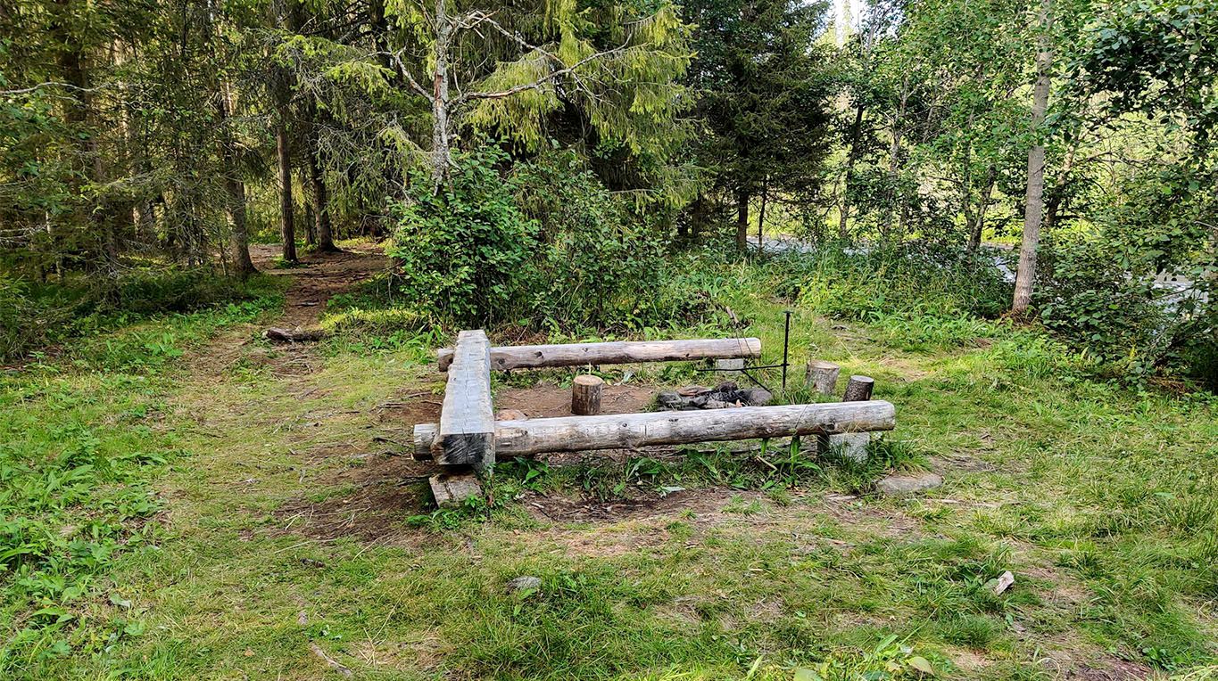
In the Karhunkierros national park, camping is intended for the campsites and allowed next to the lean-to and fixed fireplaces. It is prohibited outside of the aforementioned areas. Fire-making is restricted to fixed fireplaces, such as those found near lean-tos.
Internet, mobile connectivity
Even in Finland, a country known for its mobile networks - national parks have patchy connectivity. It is slightly better at high elevations, like on top of ridges, and similarly worse in valleys.
Of the day's trail, Internet connectivity was decent at the beginning and at the end, but worse in the middle of the trail.
If you have a satellite connection contract, that's, of course, an altogether other matter.
Vocabulary, translations used in the post
| English | Finnish | Notes and what is it? |
|---|---|---|
| Bear's trail | Karhunkierros | An 82km trekking/hiking trail through areas and national parks in Salla, Oulanka and Kuusamo areas. The most popular hiking trail in Finland. |
| Gravelake | Hautajärvi | The lake from which Koutajoki flows, the name is a free-form translation of the name of the lake at the northern end of the Karhunkierros trail. |
| Kouta-river | Koutajoki | The river that flows from Hautajärvi, past the Rytiniva campsite, at the northern end of the Karhunkierros trail. |
| Wood horsetail | Metsäkorte | Latin: Equisetum Sylvaticum, the up to 60cm tall bright green undergrowth plant, with light stick-like leaves. |
| Needle ditch | Puikko-oja | A free-form translation of the name, by the author, of the stream in the picture. |
| Porridge | Puuro | A popular breakfast that is very light to carry in dry form. |
| Oulanka national park | Oulangan kansallispuisto | A large national park in North Finland, within which the Karhunkierros trail resides. |
Disclaimers
On product placement
- There can be mentions of product names as chosen by the author, but the videos or photos do not contain paid promotions like product placement, sponsorship, or endorsement.
Further reading about this trip
Related content
- Listing of blog posts related to Oulanka national park
- Location, Oulanka National park
Member discussion